Chemuyil Beach 2026: Sea Turtles, Halocline & Free Snorkeling on the Riviera Maya
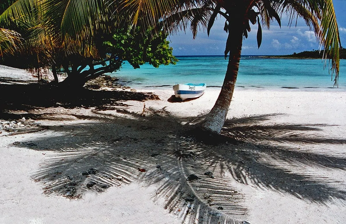
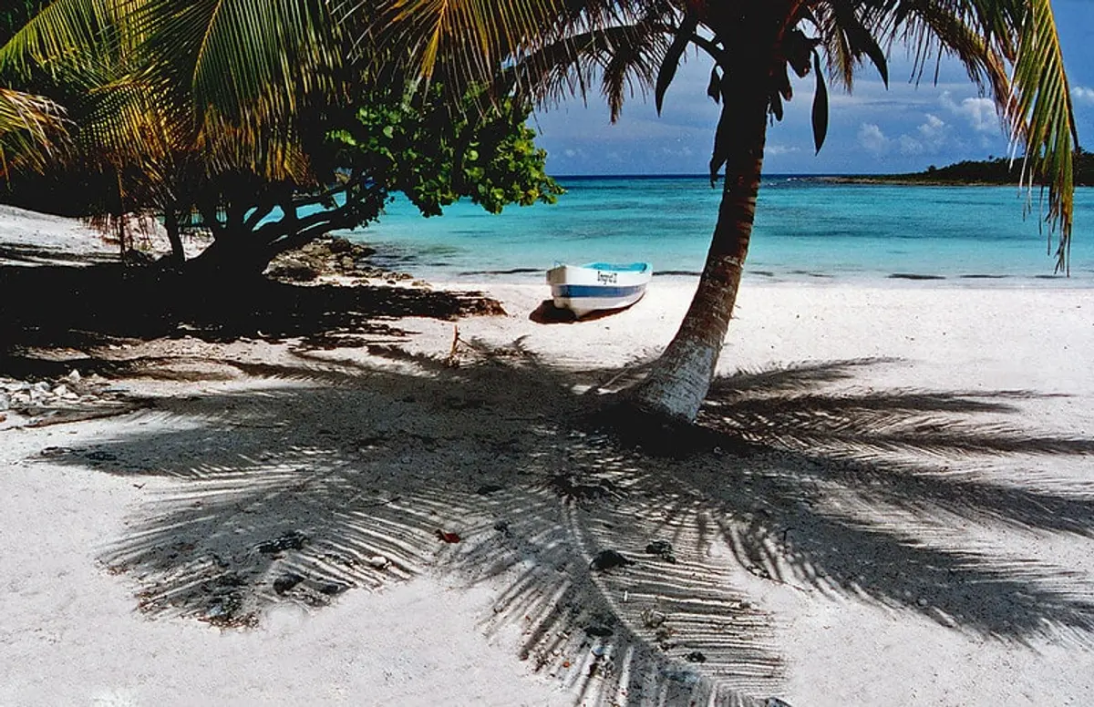
Chemuyil is a protected bay at Km 96 on Highway 307, between Akumal and Xel-Há in the municipality of Tulum, Quintana Roo. It has free sea turtle snorkeling, a visible halocline, Cenote Xunaan-Há 2 minutes from the sand, and coral crevices at the bay mouth — all without a tour guide, entrance fee, or beach club.
That last part is the point. Akumal, 5 km north, has been organized into regulated turtle zones with paid guides and capacity limits. Chemuyil is what Akumal used to be: a protected bay where you bring your snorkel, get in the water, and figure it out yourself. You can compare car rental prices on RentCars to reach it from Tulum or Playa del Carmen.
This guide covers snorkeling conditions, the bay mouth, monthly conditions, how to get there from each major hub, and how Chemuyil fits into a Riviera Maya driving day.
Where Is Chemuyil?
Chemuyil sits at Km 96 on Highway 307 (the main Cancún–Tulum road), in the municipality of Tulum, Quintana Roo. It’s 5 km south of Akumal and 15 km north of Tulum town.
The bay is shaped by natural limestone ridges that create a calm, semi-enclosed lagoon. Unlike the open Caribbean beaches at Playa del Carmen or Tulum, the sheltered geometry keeps the water calm enough for snorkeling even on windy days.
Distances from major hubs:
| Origin | Distance | Drive Time | Colectivo |
|---|---|---|---|
| Akumal | 5 km | 5 min | Walk (20 min) or 10 MXN |
| Tulum | 20 km | 25 min | 30 MXN north on Hwy 307 |
| Playa del Carmen | 43 km | 45 min | 40–50 MXN south on Hwy 307 |
| Cancún | 95 km | 90 min | Not practical (take ADO then colectivo) |
| Cobá | 75 km | 1 hr via Route 109 | Not served |
Snorkeling at Chemuyil: What to Expect
Sea Turtle Snorkeling (Bay Center)
The same seagrass beds that attract green and loggerhead turtles to Akumal extend south through Chemuyil bay. Turtles feed in the shallow (1–3 meter) areas along the northern edge in the early morning — typically 7 to 10 AM before human traffic increases.
What to know:
- No designated turtle zones, no rope lines, no guided tours required
- Bring your own snorkel mask and fins — no rentals on the beach
- Akumal has gear rental; if doing both, rent in Akumal and drive/walk south
- Keep 2 meters from turtles — federal law across all of Riviera Maya
- Biodegradable reef-safe sunscreen is required (environmental regulation)
The Halocline (Bay North)
In the northern section of the bay, underground freshwater rivers — part of the massive Yucatan Peninsula cave system — emerge near the ocean floor. Where the freshwater meets saltwater, the difference in density creates a visible shimmering distortion in the water, like looking through wavy glass.
The effect is strongest early morning before currents and wave action mix the layers. You don’t need dive certification — it’s visible from the surface in 1–2 meters of water.
The Chemuyil halocline is less dramatic than the ones inside cavern cenotes (like Cenote Dos Ojos), but it’s free and accessible to any snorkeler.
Bay Mouth Coral and Crevices (Advanced Zone)
Past the northern tip of the bay, where the limestone ridge meets open water, the seafloor changes character. The seagrass gives way to deeper water (5–8 meters) with sandy bottom crevices between dark limestone walls. This is where marine diversity increases: parrotfish, angelfish, trumpetfish, the occasional barracuda, sea fans anchored in the rock faces.
The crevices are visible from the surface but reward snorkelers who free-dive down. This section is exposed to open water — more current, less predictable than the bay center. Intermediate to advanced snorkelers only.
Marine life by zone:
| Zone | Depth | What You’ll See |
|---|---|---|
| Bay center (seagrass) | 1–3 m | Sea turtles, blue tang, sergeant major, spotted eagle ray |
| Bay north (halocline) | 1–2 m | Halocline visual effect, small fish in and around freshwater plumes |
| Bay mouth (crevices) | 5–8 m | Parrotfish, angelfish, trumpetfish, sea fans, small barracuda |
Cenote Xunaan-Há
A 2-minute walk from the sand, Cenote Xunaan-Há is a small freshwater cenote connected to the underground river system. Entry ~80–100 MXN. The water is clear, cool, and a stark contrast to the saltwater 50 meters away.
It’s not the dramatic cavern experience of Cenote Dos Ojos or the photogenic platforms of Cenote Suytun — but accessible to anyone, no certification required.
Chemuyil vs Akumal: Which Is Better?
| Chemuyil | Akumal | |
|---|---|---|
| Sea turtles | Yes — unregulated, self-guided | Yes — organized zones, guides |
| Snorkel gear rental | No (BYO or rent in Akumal) | Yes, multiple rental shops |
| Beach clubs | None | Several (Half Moon Bay area) |
| Crowds | Low–medium | Medium–high (especially weekends) |
| Water calm | Very calm (protected bay) | Calm (Half Moon Bay) |
| Cenote nearby | Yes (Xunaan-Há, 2 min walk) | No (nearest is 15+ min) |
| Bay mouth diving | Yes (crevices, walls, more fish) | No equivalent |
| Facilities | Basic palapas, occasional vendors | Restaurants, bars, restrooms |
| Entry fee | Free | Free (bay access) |
| Best for | Experienced snorkelers, quiet beach day | Families, first-time turtle snorkelers |
The honest call: First-timers who’ve never snorkeled with sea turtles should start at Akumal — the guided format makes it easier to find turtles and interact safely. Experienced snorkelers who want independence, more marine diversity, and zero crowds: Chemuyil.
Doing both on the same day is easy. Start at Akumal at 8 AM (rent gear, guided turtle zone), drive 5 km south to Chemuyil by 11 AM (independent snorkeling, halocline, bay mouth, cenote).
X’cacel — The Sea Turtle Nesting Beach Next Door
Two kilometers south of Chemuyil on Highway 307, X’cacel (esh-kah-SEL) is a federally protected beach and the primary sea turtle nesting site for the central Riviera Maya. No development, no beach clubs — set aside specifically for turtle nesting habitat.
During nesting season (May–October), loggerhead, green, and leatherback turtles come ashore at night. July–August peak hatching. X’cacel also has a freshwater cenote where you can swim between freshwater and the Caribbean within 50 meters.
X’cacel is free. A gate on the highway has volunteers who sometimes collect a small voluntary conservation donation. No facilities — bring everything.
Monthly Conditions at Chemuyil
| Month | Sargassum | Water Clarity | Turtles (Bay) | Crowds | Overall |
|---|---|---|---|---|---|
| Jan | None | Excellent (20 m+) | Yes | Low | ⭐⭐⭐⭐⭐ |
| Feb | None | Excellent | Yes | Low–Medium | ⭐⭐⭐⭐⭐ |
| Mar | None | Excellent | Yes | Medium | ⭐⭐⭐⭐⭐ |
| Apr | None–trace | Very Good | Yes | Medium | ⭐⭐⭐⭐ |
| May | Light–moderate | Good | Yes | Low | ⭐⭐⭐ |
| Jun | Moderate–heavy | Variable | Yes | Low | ⭐⭐ |
| Jul | Heavy | Variable | Yes + nesting (X’cacel) | Low | ⭐⭐ |
| Aug | Heavy | Variable | Yes + hatching (X’cacel) | Low | ⭐⭐ |
| Sep | Moderate | Variable | Yes | Very Low | ⭐⭐ |
| Oct | Light–moderate | Good | Yes | Low | ⭐⭐⭐ |
| Nov | None–trace | Very Good | Yes | Low | ⭐⭐⭐⭐ |
| Dec | None | Excellent | Yes | Low–Medium | ⭐⭐⭐⭐⭐ |
Sargassum note: Chemuyil’s protected bay shape means seaweed accumulates more than on open beaches. The bay mouth clears faster. Check UNAM’s sargassum monitor before summer visits.
Weekday vs weekend: Noticeably less crowded on weekdays. Weekend mornings (8–10 AM) before the day-trippers arrive are the best window.
Getting to Chemuyil
By car: Highway 307 south from Playa del Carmen or north from Tulum. Look for a small sign at Km 96 on the west side (road sign is easy to miss). Parking area is unpaved and limited — arrive before 10 AM on weekends. Compare car rental prices on RentCars.
By colectivo: Shared minivans run Highway 307 between Playa del Carmen and Tulum for 30–50 MXN. Tell the driver “Chemuyil” — you’ll be dropped on the highway and walk ~200 meters to the beach. Leave from the ADO station area in Playa del Carmen or from Tulum’s colectivo departure points.
From Tulum: Colectivo north (~30 MXN, 25 min) or taxi (~150–200 MXN one-way). No Uber in Tulum — taxis only.
From Cancún: 95 km south, 90-minute drive. Not worth a dedicated Cancún day trip — base in Playa del Carmen or Tulum and combine with Akumal and X’cacel.
What to Bring
Chemuyil has minimal facilities:
- Snorkel mask and fins — no rentals; rent in Akumal first
- Reef-safe biodegradable sunscreen — required by Mexican environmental law, genuinely matters
- Water and food — vendors on weekends, unreliable otherwise
- Cash pesos — cenote entry (~80–100 MXN), parking, any vendors
- Underwater camera or GoPro — turtle encounters justify it
- Beach umbrella — palapas available but compete for them
Where to Stay Near Chemuyil
Almost no accommodation in Chemuyil village. Practical bases:
Akumal (5 km north): Budget to mid-range hotels closest to Chemuyil with actual services.
Tulum (20 km south): Boutique jungle cabins to hotel zone beach clubs. See our Tulum travel guide for the full breakdown.
Playa del Carmen (43 km north): Best transport connections, widest accommodation range. See our Playa del Carmen guide.
Combining Chemuyil With Other Stops
Chemuyil works best as part of a Riviera Maya driving day:
Akumal → Chemuyil → X’cacel (full day): Start Akumal 8 AM (rent gear, turtle zone), Chemuyil by 11 AM (halocline, bay mouth, cenote), X’cacel by 2 PM (nesting beach, second cenote). Back to Tulum or PDC by 5 PM. Three distinct marine experiences, zero entrance fees beyond cenotes.
Chemuyil + Xel-Há: Xel-Há water park is 10 km south. Expensive all-inclusive ticket, but if you’re going, Chemuyil is a free morning stop on the same highway.
With Tulum ruins: Tulum archaeological zone opens at 8 AM, 20 km south. Do ruins first (8 AM), drive north to Chemuyil by 11 AM.
For day-by-day Riviera Maya itineraries, see our 7 Days in Yucatan guide.
Riviera Maya Beach Context
Chemuyil sits in the most marine-diverse stretch of the Riviera Maya — between the coral reefs of Akumal and the protected mangroves south of Tulum. The corridor from Km 104 (Akumal) to Km 85 (Tulum approach) passes through small, low-development beaches that preserve what this coastline looked like before Cancún-scale development arrived.
See also: Yucatan beaches guide, best excursions in the Riviera Maya, day trips from Playa del Carmen.
For complete Riviera Maya timing — hurricane risk, sargassum patterns, and month-by-month conditions across the peninsula — see our best time to visit Yucatan and best time to visit Cancun guides.