
Driving in Mexico 2026: Is It Safe for Foreigners? Toll Roads, Insurance, and TIP Rules
Driving in Mexico is safe for most foreigners, but only if you treat it like a real road trip, not a casual extension of driving in the US or Canada. The people who have smooth drives here usually make the same choices: they use toll roads between cities, avoid night driving, sort Mexican insurance before pickup, and know whether their route requires a TIP.
That is the gap most ranking pages miss. Some focus only on border paperwork. Others jump straight to scenic routes without explaining what actually makes driving here easy or stressful. This guide does both, so you can answer the real question faster: should you actually drive in Mexico for your trip, or are you better off with a bus, flight, or train?
Driving in Mexico in 30 Seconds
Yes, driving in Mexico is safe for most travelers if you stick to toll roads for long intercity stretches, drive in daylight, carry Mexican liability insurance, and avoid casually wandering into high-risk states or remote libre roads after dark.
| If you’re doing this… | Should you drive? | Why |
|---|---|---|
| Yucatán loop, Baja, Oaxaca day trips, Los Cabos | Yes | Easy roads, flexible stops, good payoff vs buses |
| Renting a car at a major airport | Usually yes | Simplest way to road trip if insurance is clear before pickup |
| Crossing the border with your own car | Maybe | Fine if you handle Mexican insurance + TIP rules first |
| CDMX to Oaxaca, Guadalajara, Monterrey | Usually no | Long direct bus or flight options are easier |
| Rural night driving or fast multi-state itineraries | No | This is where most avoidable problems happen |
Best Mexico driving plan by traveler type
| Traveler type | Best move | Why |
|---|---|---|
| First Mexico road trip | Rent in Yucatán, Baja, Oaxaca, or Los Cabos | These are the easiest regions to drive confidently |
| Bringing your own US or Canadian car | Double-check TIP rules before you cross | This is the main paperwork mistake foreigners make |
| Nervous driver | Use cuotas only and finish before dark | This removes most of the stress fast |
| Solo city-hopper | Skip the car on long direct routes | ADO, ETN, and flights are often easier than parking |
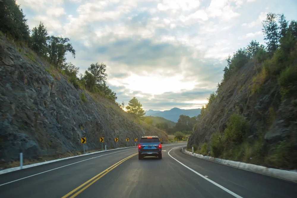
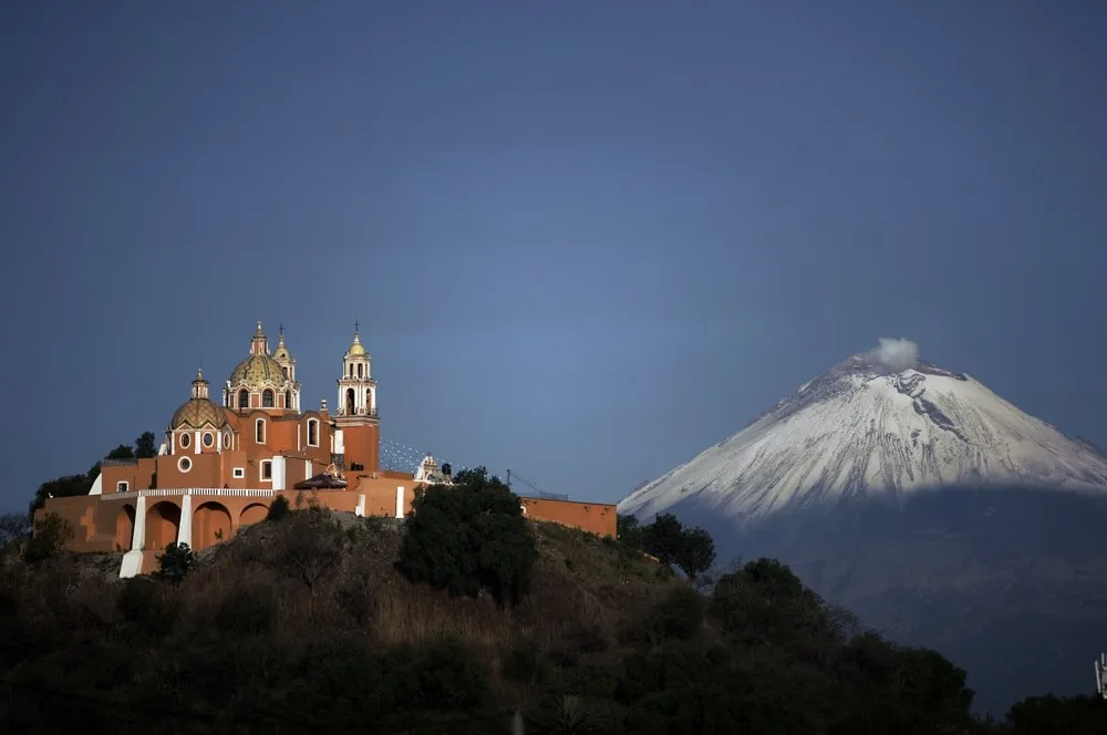
Mexico has 250,000+ km of roads, including a modern toll highway network that is much better than many first-timers expect. The scenery from a car window, from deserts and volcanoes to jungle corridors and colonial highlands, is something you simply cannot get from a bus.
This guide covers the real decision points: safety, permits, insurance, road types, common mistakes, and 8 of Mexico’s best road trips. If you still need route-specific planning, start with Driving From the US to Mexico, Best Mexico Road Trips, Renting a Car in Mexico Guide, and Is Mexico Safe?.
Is It Safe to Drive in Mexico?
Yes — with the right precautions. The key is knowing which roads to use and when.
The two-road system:
- Cuotas (toll roads): Modern, well-maintained, patrolled highways. Cost 30–300 MXN per segment. These are the safe choice for intercity driving.
- Libres (free roads): Scenic, go through towns, full of topes, slower. Fine for short stretches during daytime. Avoid for long stretches at night.
Rules that keep you safe:
| Rule | Why |
|---|---|
| Drive daytime between cities | Unmarked topes + livestock + potholes at night |
| Stick to cuotas for highway stretches | Patrolled, maintained, faster |
| Check advisories before driving in unfamiliar states | Tamaulipas, Colima, Guerrero are Level 3-4 |
| Never drive under the influence | DUI checkpoints are active in tourist areas |
| Lock valuables out of sight | Petty theft at red lights in cities |
| Fill up at PEMEX stations you see, don’t wait | Gas stations are sparse in rural areas |
Rick’s honest take: The fear is wildly overblown. He’s driven Oaxaca, Chiapas, Baja, the Yucatán, the colonial circuit, and the Pacific coast. The biggest hazard is always topes, not crime.
Common First-Timer Mistakes
- Driving after sunset because the map says you still have 2 hours left. In Mexico, those 2 hours can include topes, livestock, fog, roadworks, and slow truck traffic.
- Choosing libre roads just to save toll money. On many routes, cuotas buy you better pavement, less stress, and a much safer day.
- Assuming your normal car insurance works. It does not. Sort Mexican liability coverage before you cross or leave the airport.
- Not checking whether your own foreign-plated car needs a TIP. Baja and parts of Sonora are exceptions, most of Mexico is not.
- Planning a city-center hotel with no parking strategy. In places like Guanajuato, Oaxaca, and Mexico City, parking logistics matter more than the final 500 meters of drive time.
Documents and Requirements for Driving in Mexico
What to carry in your car at all times:
- Vehicle registration card
- Valid Mexican liability insurance (your US/Canadian policy does NOT work)
- Driver’s license (US/Canadian accepted — no IDP required)
- Emission sticker (if driving a Mexican-registered vehicle)
- TIP permit (if you brought a foreign-plated car into Mexico — see below)
Temporary Import Permit (TIP)
If you drive a US or Canadian-plated car into Mexico beyond the border free zones, you need a TIP (permiso de importación temporal de vehículo).
Not required for:
- Driving within Baja California (whole peninsula)
- Driving within the Sonora free zone (~20km border strip)
Required for everything else.
Apply at banjercito.com.mx online (easier) or at any major border crossing.
Requirements:
- Vehicle title or registration
- Valid passport
- Driver’s license
- Credit or debit card (for the $200-$400 USD refundable deposit)
The permit must be canceled at the border when you exit — or the deposit is forfeited and future TIPs become harder to get.
Mexican Car Insurance
This is non-negotiable. Your US/Canadian insurer will not cover you in Mexico. If you cause an accident without Mexican insurance, you can be detained until damages are sorted.
Buy Mexican insurance from:
- Your rental car company (automatic for rentals)
- Online providers: MexicanInsurance.com, Baja Bound, Sanborn’s
- At the border crossing
Cost: ~$15-30 USD/day for liability. Worth every peso.
Compare car rental deals with insurance included →
For personal travel insurance, focus on emergency medical care and evacuation, especially if your route includes remote highways, mountain roads, or long stretches between hospitals.
Understanding Mexican Roads
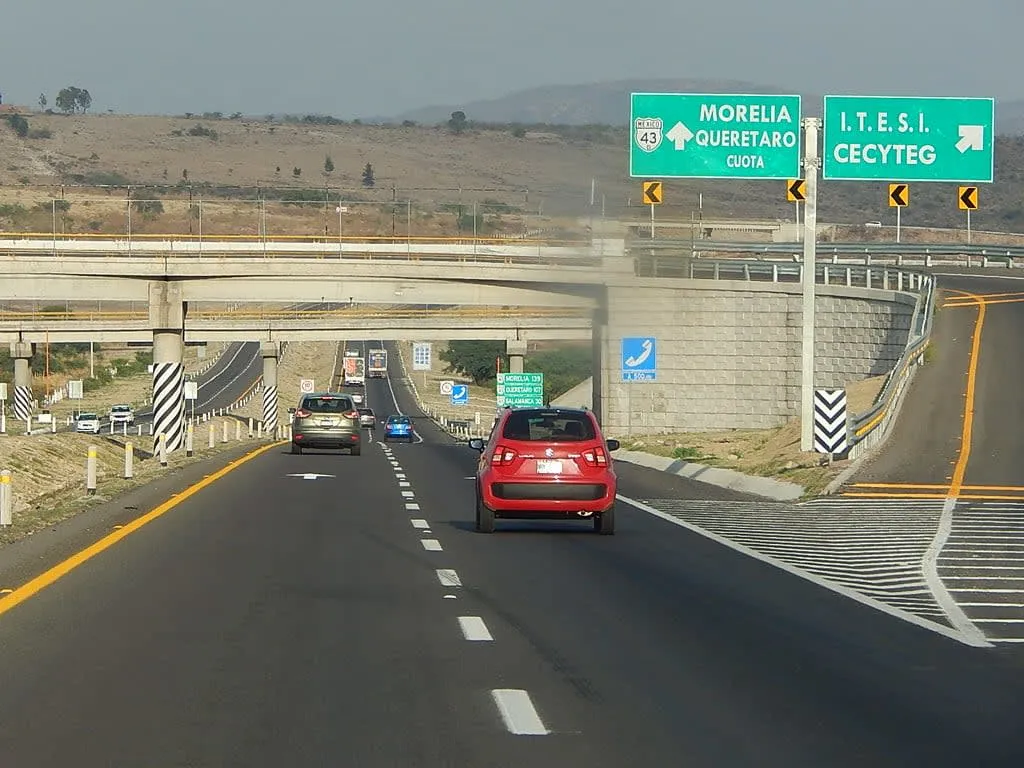
Toll Roads (Cuotas)
Numbered with a “D” suffix (MEX-150D, MEX-57D). Modern, fast, well-maintained. Tolls paid at casetas — have cash in MXN (most don’t accept cards, though the major ones do). Budget 200-600 MXN for a typical intercity drive.
Free Roads (Libres)
Numbered without the “D”. Slower, more interesting, full of character — and topes. Great for short scenic stretches. Not recommended for long overnight hauls.
Topes (Speed Bumps)
Mexico’s #1 driving hazard. They appear:
- Before every small town and village
- Near schools and churches
- On libre roads throughout
- Sometimes with no warning sign at all
Strategy: Slow to 10-15 km/h approaching any sign of civilization. You’ll save your suspension.
Green Angels (Ángeles Verdes)
Mexico’s free roadside assistance service. Green pickup trucks that patrol major highways. If you break down on a cuota highway, call 078 (free). They provide fuel, basic repairs, and towing — all free. This is a genuine government service Rick has used himself.
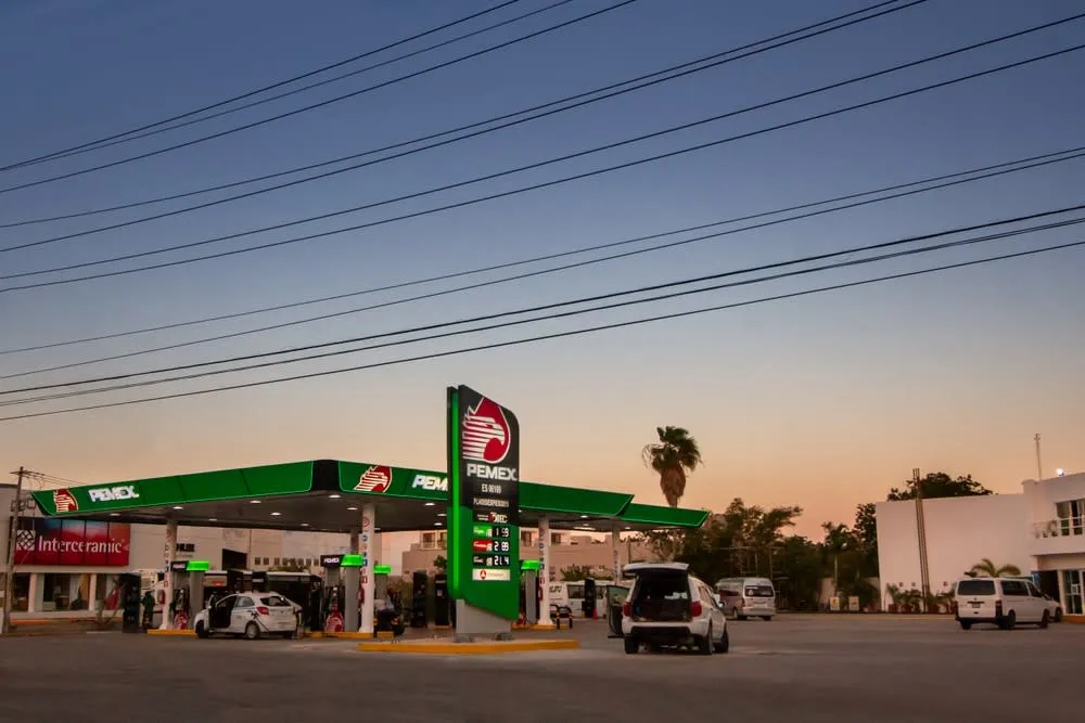
Gas Stations (PEMEX)
Mexico’s national gas company. Prices are nationally regulated — same everywhere. Premium (Magna) and plus grades available. In cities, every few km. In rural areas — fill up whenever you see one. Running out of gas in Chihuahua or the Yucatan interior is not fun.
Tip: Watch for attendants who “forget” to zero the pump before your fill. Confirm it reads 0 before they start pumping.
Renting a Car in Mexico
Renting is the easiest way to road trip Mexico. All major companies operate at international airports (CUN, GDL, OAX, MEX, MID, PVR, SJD, TGZ, VER).
What to know:
- Book in advance — prices double at the counter vs. online pre-booking
- Insurance: The rental company’s insurance may be enough — but check carefully for deductibles. Many travelers buy their own supplemental coverage.
- Car type: Compact/sedan works for highway and city driving. SUV recommended for Oaxaca valleys (roads to Hierve el Agua), Baja off-road segments, or Chiapas mountain routes.
- Credit card deposit: Required. Debit cards are often refused at rental counters.
- One-way rentals: Available but expensive due to relocation fees. Plan round trips when possible.
Find the best rental rates for Mexico →
8 Best Road Trips in Mexico
Road Trip 1: Baja California Peninsula (Norte to Sur)
Route: Tijuana → Ensenada → Guerrero Negro → Loreto → La Paz → Cabo San Lucas Distance: ~1,700 km (one way) Duration: 7-14 days Best time: November–April
The classic Baja road trip. Baja is uniquely safe for driving — no TIP required, no major safety concerns, excellent highway (MEX-1). The scenery shifts from Pacific wine country to lunar desert to Sea of Cortez turquoise.
Highlights:
- Ensenada Valle de Guadalupe wine country (80+ wineries)
- Guerrero Negro gray whale lagoon (Jan-Apr: get in a panga and touch them)
- Bahía Concepción turquoise coves and palapa camping
- Loreto — oldest town in Baja, Misión historic district
- La Paz whale sharks (Oct-May), Balandra Beach (free, Mexico’s most beautiful)
- Cabo San Lucas El Arco water taxi, Medano Beach
Practical: MEX-1 is well-maintained from TJ to Cabo. Fill up at every town. Guerrero Negro is 7 hours from Tijuana — break it up with a stop at Catavina boulder field. The ferry from La Paz to Mazatlán cuts the return drive.
See: La Paz Travel Guide | Los Cabos Travel Guide
Road Trip 2: The Yucatan Peninsula Loop
Route: Cancún → Tulum → Bacalar → Chetumal → Campeche → Mérida → Uxmal → Valladolid → Chichen Itza → Cancún Distance: ~1,200 km circular Duration: 8-12 days Best time: November–April
The Yucatan is Mexico’s most road-trip-friendly region. Flat, safe, excellent highways, all major sites within easy driving distance of each other. No toll highways needed for the circuit — everything is well-maintained libre roads.
Highlights:
- Tulum ruins at 8 AM (before tour buses) and cenotes along Highway 307
- Bacalar Lagoon of Seven Colors and stromatolites
- Campeche UNESCO walled city (arrives 2 hours from Bacalar)
- Uxmal Puuc pyramids without Chichen Itza crowds
- Mérida as base for Celestun flamingos and Chichen Itza morning arrival
- Valladolid 4-cenote circuit and staying near Chichen Itza
Practical: The Maya Train is an alternative to driving for this circuit — but a rental car gives you flexibility that the train doesn’t.
See: Yucatan 7-Day Itinerary | Cancun to Tulum | Chichen Itza Guide
Road Trip 3: Oaxaca Valley Circuit
Route: Oaxaca City → Zaachila → Ocotlán → Mitla → Tlacolula → Teotitlán del Valle → Santiago Matatlan → Oaxaca City Distance: ~120 km circular Duration: 1-3 days Best time: Year-round (avoid Hierve el Agua June-October — closed)
The Oaxaca Valley isn’t long-distance driving — it’s short hops between villages, each with something specific to see or buy. This is Mexico road-tripping at its most concentrated.
Highlights:
- Mitla ruins — the only pre-Hispanic site in Mexico with no mortar (geometric mosaics)
- Tlacolula Sunday market (the best non-touristy market in Mexico)
- Teotitlán del Valle — Zapotec women weaving on back-strap looms with natural dyes
- Santiago Matatlan — “mezcal capital of the world,” 200+ registered palenques
- El Árbol del Tule — 2,000-year-old Montezuma cypress (biggest tree by circumference in the world)
Practical: Rent a car in Oaxaca City. Paved roads to all destinations. Hierve el Agua requires a 4WD-capable vehicle for the final stretch (or hire a local guide with truck).
See: Day Trips from Oaxaca City | Oaxaca 5-Day Itinerary
Road Trip 4: Colonial Heartland Circuit
Route: Mexico City → Querétaro → San Miguel de Allende → Guanajuato → Morelia → Mexico City Distance: ~700 km circular Duration: 7-10 days Best time: Year-round (October for Cervantino festival in Guanajuato)
Mexico’s most culturally rich road trip. Five UNESCO World Heritage cities connected by excellent toll highways. This is Rick’s personal recommendation for first-time visitors who want depth over beaches.
Highlights:
- Querétaro: 74-arch aqueduct, wine route, hot air ballooning (cheaper than Teotihuacan)
- Bernal: World’s 3rd largest monolith, 30 km from Querétaro
- San Miguel de Allende: Parroquia at sunrise, Sanctuary of Atotonilco, hot springs
- Guanajuato: Underground tunnels, Alhóndiga independence murals, Mummy Museum
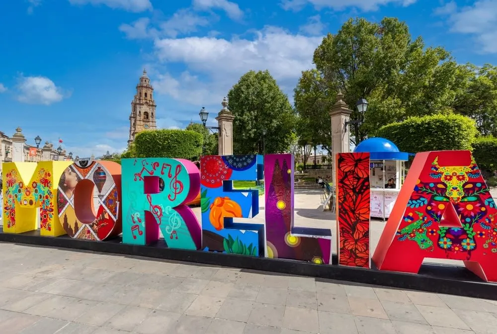
- Morelia: 4,500-pipe organ, aqueduct, best carnitas in Mexico
Practical: Use MEX-57D north from CDMX, then libre roads between colonial cities. All cities have safe, walkable historic centers. Park and walk — driving in old city centers is chaos.
See: Guanajuato Travel Guide | San Miguel de Allende Guide | Morelia Guide
Road Trip 5: Pacific Coast — Mazatlán to Puerto Vallarta
Route: Mazatlán → San Blas → Sayulita → Punta Mita → Puerto Vallarta Distance: ~350 km Duration: 4-7 days Best time: November–May
Mexico’s Pacific coast has zero sargassum (unlike the Caribbean) and a completely different vibe — fishing villages, surf breaks, colonial towns, and whale-watching season November-March.
Highlights:
- Mazatlán: pulmonia taxi rides, aguachile (invented here), 21km malecón, Stone Island water taxi beach
- San Blas: mangrove boat tours, Isla del Rey ruins, La Tobara freshwater spring
- Sayulita: surf village, sea turtle releases July-November, Wednesday market
- Punta Mita: St. Regis beach vs. free public beach at Anclote (same water, 1/10th the price)
- Puerto Vallarta: whale watching December-March (600+ humpbacks), Malecón sculptures, Romantic Zone
Practical: MEX-15D toll road Mazatlán-Tepic, then MEX-200 libre coastal road. The coastal section is slow (topes through every fishing village) but the scenery earns it.
See: Mazatlán Guide | Puerto Vallarta Guide | Sayulita Guide
Road Trip 6: Durango to Zacatecas Mining Route
Route: Durango → Nombre de Dios → Fresnillo → Zacatecas Distance: ~350 km Duration: 3-5 days Best time: Year-round (avoid August rainy peak in Durango)
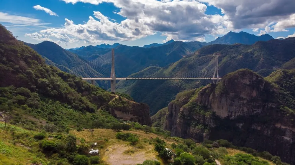
Silver mining history, colonial wealth, movie set landscapes, and Mexico’s most dramatic bridge. The Baluarte Bridge (MEX-40D, Mazatlán-Durango highway) is 403m high — the tallest cable-stayed bridge in the world when it opened.
Highlights:
- Durango city: Mexican Western movie sets nearby (John Wayne filmed here), colonial historic center, Palacio de Gobierno
- Sierra de Órganos National Park: otherworldly rock formations that look like organ pipes
- Nombre de Dios Pueblo Mágico: La Constancia springs, colonial convents
- Fresnillo tourist mines
- Zacatecas: cable car, Bufa Hill, silver mine tour, zacapaxtles local pastries, mezcal cenizo
Practical: MEX-40D from Mazatlán to Durango is the most dramatic road in Mexico (Baluarte Bridge, Sierra Madre descent). The Mazatlán-Durango section alone is worth the drive.
See: Zacatecas Food Guide | Mazatlán Guide
Road Trip 7: Copper Canyon (El Chepe + Driving)
Route: Chihuahua → Creel → Divisadero → Bahuichivo/Cerocahui → El Fuerte (by El Chepe train) Distance: 660 km by rail; driving accessible from Chihuahua City to Creel (240 km) Duration: 4-7 days Best time: April-October (spring wildflowers; avoid winter frost at canyon rim)
The Copper Canyon is 4× larger than the Grand Canyon — and almost entirely unknown outside Mexico. This trip combines limited driving (Chihuahua City to Creel is road-accessible) with El Chepe train for the canyon descent.
Driving to Creel: MEX-16 from Chihuahua City to Creel (240 km, 3.5 hours, paved highway). No need for 4WD unless you’re venturing off marked routes.
From Creel by car: Valle de los Hongos, Lago Arareko, Cascada Cusarare — all reachable by paved or gravel road.
The canyon descent (Creel → Batopilas): 160 km, 4-5 hours, unpaved mountain road. Spectacular, but requires a high-clearance vehicle and daylight driving. Not for nervous drivers.
See: Copper Canyon Guide | Creel Travel Guide | Chihuahua City Guide
Road Trip 8: Oaxaca Coast to Chiapas
Route: Oaxaca City → Puerto Escondido → Mazunte/Zipolite → Huatulco → San Cristóbal de las Casas Distance: ~680 km Duration: 7-10 days Best time: November–April (dry season, sea turtles Sep-Nov at Playa Escobilla)

The new Autopista Barranca Larga-Ventanilla (Highway 135D), fully open since 2024, cuts the Oaxaca City–Puerto Escondido drive from 7-8 hours to 3-3.5 hours. Most English guides haven’t caught up yet.
Highlights:
- Puerto Escondido: No sargassum, Pacific surf, bioluminescent lagoon at Manialtepec (July-October)
- Mazunte: Punta Cometa (southernmost accessible point in North America), organic cosmetics
- Zipolite: Mexico’s main nudist beach, deeply relaxed village vibe
- Playa Escobilla: Sea turtle mass arrivals (100,000+ per night, June-November)
- Huatulco: 9 bays, national marine park, coffee farm tours
- San Cristóbal de las Casas: Chamula, amber market, Sumidero Canyon boat tour
Important: The Hwy 190 section from Oaxaca to San Cristóbal via Tehuantepec is occasionally blockaded by CNTE teacher strikes near Juchitán. Check conditions before driving this stretch. The blockades typically last 1-3 days.
See: Puerto Escondido Guide | Oaxaca to Puerto Escondido | Oaxaca to San Cristóbal
Driving in Mexico: Practical Tips
Fuel
PEMEX is still the default you will see most often, but it is no longer the only brand on Mexican roads. Magna (regular), Premium, and diesel are widely available on major routes. Fill up in every city anyway, because rural stretches can still go 100+ km without a convenient station.
Military Checkpoints
Normal and common. Slow down, be polite, have documents ready. If they ask to inspect the car, cooperate. These are routine, not personal.
Red Lights in Cities
In cities like CDMX, keep windows up and doors locked at major intersections at night. This is standard city-driving awareness, not a Mexico-specific crisis.
What to Do If Pulled Over by Police
A percentage of traffic stops are fishing expeditions for bribes (mordidas). Rick’s approach: be polite, ask for a boleta (ticket), and say you’ll pay at the official office. Most fishing stops end there. Never hand cash through the window proactively — that’s an invitation.
Apps to Use
- Waze: Works excellently in Mexico. Shows topes on familiar routes.
- Google Maps: Good for directions. Set to “avoid tolls” if you want libre route, or leave default for cuota.
- Gas Guru Mexico: Find PEMEX stations ahead.
Best Roads to Drive in Mexico
| Road | Route | Why It’s Special |
|---|---|---|
| MEX-40D | Mazatlán → Durango | Baluarte Bridge, Sierra Madre descent, one of Mexico’s most dramatic drives |
| MEX-1 | Tijuana → Cabo | Classic Baja, desert-to-sea transition, easy free-zone logistics |
| MEX-307 | Cancún → Tulum | Cenote access, Riviera Maya stops, beginner-friendly highway |
| MEX-135D | Oaxaca → Puerto Escondido | Huge time savings, best modern coast access from Oaxaca City |
| MEX-200 | Mazatlán → Puerto Vallarta | Pacific coast towns, beaches, and surf villages |
| MEX-57D | CDMX → Querétaro | Fast, modern, best gateway into the colonial heartland |
Should You Drive or Use Public Transport in Mexico?
Drive when:
- You’re doing Oaxaca valleys, Yucatan circuit, Baja, Copper Canyon approaches
- You’re 3+ people (car becomes cheaper per person than ADO)
- You want flexibility to stop at ruins, cenotes, or roadside markets
- You have a rental car included in your trip
Take ADO/ETN bus when:
- It’s a direct point-to-point (CDMX → Oaxaca, CDMX → Guadalajara)
- You’re going overnight (sleep on the bus, arrive refreshed)
- You’re solo and the math doesn’t work for a rental
- You’re going to destinations where car parking is a nightmare (CDMX, Guanajuato city)
Take the Maya Train when:
- You’re traveling the Yucatán/Caribbean corridor and don’t need a car
See: Driving from the US to Mexico | Is Mexico Safe? | Best Mexico Road Trips | Renting a Car in Mexico Guide
Rick has driven Baja, Oaxaca, Chiapas, the colonial circuit, and the Pacific coast. His rule: cuota by day, never alone at night on rural roads, and always fill the tank before leaving a city.