
Hiking in Mexico 2026: 15 Best Trails From Desert to Jungle
Hiking in Mexico: More Than Jungle Trails
Mexico’s hiking offer covers more terrain than almost any country its size: active volcanoes above 5,000 meters, a canyon system bigger than the Grand Canyon, cloud forest at 3,000 meters in Oaxaca, jungle paths threading through abandoned Mayan cities, and desert trails in Baja where cardón cacti tower overhead.
This is a practical guide to 15 of the best hikes in Mexico, organized by region, with real information about difficulty, cost, and logistics.
Northern Mexico
1. Copper Canyon Multi-Day Trek — Barrancas del Cobre, Chihuahua
The Barrancas del Cobre system is six interconnected canyons covering an area four times the size of Arizona’s Grand Canyon — though the two are often compared, Copper Canyon is deeper in most sections and far less visited. The Rarámuri people have lived here for centuries, running distances that defy belief on trails they’ve maintained for generations.
A proper multi-day trek here is one of the great hiking experiences in the Americas.
The routes: There’s no single “Copper Canyon trail.” Routes vary from point-to-point canyon descents (Creel to Batopilas, 2-3 days) to full traverses connecting multiple canyon systems (7+ days). Most routes pass through Rarámuri communities where basic accommodation is available in community posadas.
Difficulty: Hard. Elevation changes are significant — descents to the canyon floor can drop 1,500 meters. Terrain is rocky and trail signage is minimal outside of guided routes.
Who should go: Experienced hikers with multi-day backcountry experience. Day hikes from Creel (to Cusárare Falls, Basaseachi, Valle de los Hongos) are accessible to most fitness levels.
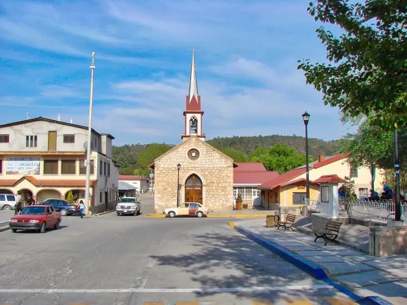
Guides: Rarámuri guides are strongly recommended for multi-day routes. They know the terrain intimately and the income is direct community support. Arrange through operators in Creel.
Cost: Guided multi-day treks 2,000-5,000 MXN per person per day, including food and guesthouse accommodation. Day hike guides from Creel: 400-800 MXN.
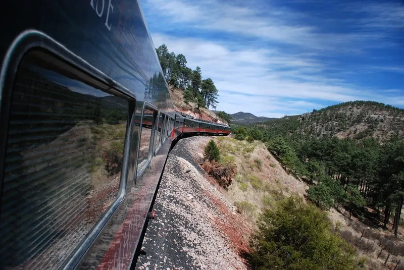
For full logistics including the Chepe Express train, see our Copper Canyon guide and things to do in Creel.
2. Basaseachi Falls Trail — Chihuahua
Cascada Basaseachi drops 246 meters in a single uninterrupted fall — one of the highest single-drop waterfalls in North America. The trail to the mirador (viewpoint) is a 5-kilometer round trip, moderate, with good signage through pine forest.
Who can do it: Most fitness levels. The trail to the main viewpoint is well-maintained. A more demanding trail descends to the waterfall base (2-3 hours one way).
Cost: 50 MXN national park entrance. No guide required.
Season: Year-round, but the falls are most powerful May-September after rains. Access road can be rough after heavy rain.
3. Parque Nacional Sierra de Órganos — Zacatecas
The volcanic rock formations here — tall, narrow columns rising from the scrub desert — look like something from a cartoon: irregular organic spires, some smooth-sided, some fractured, all improbable. The park is little visited even by Mexican standards.
Difficulty: Easy to moderate. Marked trails, 3-8 kilometers.
Cost: 30 MXN entrance.
Logistics: Base in Sombrerete, Zacatecas. Best combined with a Zacatecas city visit.
Central Mexico
4. Pico de Orizaba — Veracruz/Puebla Border
Mexico’s highest peak and the third-highest in North America at 5,636 meters (18,491 feet). The lower slopes are a strenuous but non-technical hike through scrub and rock. Above the Jamapa Glacier (around 4,200m) the route becomes technical mountaineering: crampons required, ice axe essential, steep 40-degree ice slopes near the summit.
The summit view, on a clear day, extends from the Gulf of Mexico to the Pacific — both coasts simultaneously.
Difficulty: Expert. Not a hike — a mountaineering objective.
Requirements: Certified guide (mandatory for glacier section), crampons, ice axe, high-altitude cold weather gear, prior acclimatization. Permits required.
Logistics: Base in Tlachichuca (Puebla side) or Orizaba. Refugio Piedra Grande hut at 4,260m is the standard start for summit attempts (1-2 night stay for acclimatization).
Cost: Guided summit climbs 3,500-7,000 MXN per person including hut accommodation and technical equipment rental.
Season: October through March. Conditions are most stable November-February. Summer brings afternoon thunderstorms that make summit attempts dangerous.
5. Nevado de Toluca Crater — Mexico State
At 4,690 meters, Nevado de Toluca is Mexico’s fourth-highest peak — but unlike Pico de Orizaba, it does not require technical gear. The road reaches 4,200m and a walking trail climbs to the crater rim, which holds two spectacular high-altitude lakes: Laguna del Sol and Laguna de la Luna.
Difficulty: Moderate-hard. No technical equipment, but altitude is serious. This is real high-altitude hiking — headaches, shortness of breath, and nausea are common for those who ascend too quickly.
Who can do it: Physically fit hikers who acclimatize properly. Spend a night in Toluca (2,680m) before attempting the crater. Don’t drive straight from sea level and walk to 4,690m the same day.
Cost: 80 MXN entrance. Guided day trips from Mexico City 600-1,200 MXN.
Logistics: 1.5 hours from Mexico City by car. Tour operators run day trips.
6. El Tepozteco Pyramid Hike — Morelos
An hour from Mexico City, Tepoztlán is one of those Mexican towns that’s genuinely worth visiting for its own sake — good food, artisan market, colonial architecture — plus a pyramid hike that would be the highlight of most trips.
The trail climbs steeply from the edge of town through a cliffside forest to the Tepozteco pyramid perched at 2,287 meters. The hike takes 40-60 minutes of steady climbing. The ruins are small but the view is outsized — the entire Tepoztlán valley spread out below, forested mountains on every side.
Difficulty: Moderate. Steep but short. No technical terrain.
Cost: 85 MXN entrance to the archaeological zone.
No guide required. Trail is obvious. Guided tours available from Mexico City if you want context on Aztec history.
Best time: Before 9am. Tour groups arrive by mid-morning and the trail narrows at busy sections.
7. Monarch Butterfly Reserve Trails — Michoacán/Mexico State
Between November and March, hundreds of millions of monarch butterflies overwinter in the fir forests of three sanctuaries: El Rosario, Sierra Chincua, and Cerro Pelón. The spectacle — trees orange with butterflies, clouds of them lifting and settling, the constant hum — is unlike anything else in the natural world.
The trails to the overwintering colonies are walks rather than hikes: 1-3 hours at 3,000 meters altitude through fir forest. The altitude is the main challenge.
Difficulty: Easy-moderate. Short distances, significant altitude.
Season: November through March only. Outside this window, there are no butterflies.
Cost: 80-140 MXN entrance depending on sanctuary. Guides required at most sanctuaries (they manage visitor flow to protect the colonies).
See our monarch butterfly guide for full logistics and which sanctuary to choose.
Oaxaca
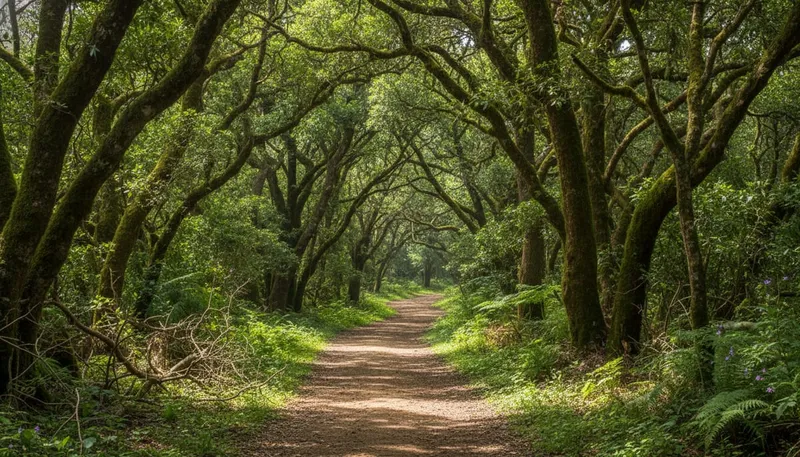
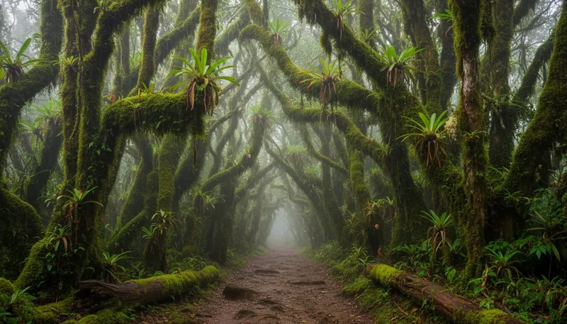
8. Pueblos Mancomunados Cloud Forest — Sierra Norte, Oaxaca
Eight Zapotec villages — Benito Juárez, Cuajimoloyas, Latuvi, Lachatao, Amatlán, La Nevería, Llano Grande, and Yavesía — share 100 kilometers of marked trail through cloud forest at 1,900-3,100 meters. This is community-managed ecotourism done right: the trails are well-maintained, the cabañas are comfortable, and the money goes to the villages.
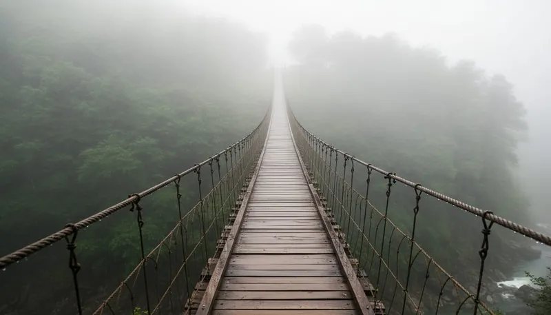
The hiking here is spectacular: pine and oak forest, suspension bridges over gorges, cloud that wraps around you mid-morning, views to the valley floor 2,000 meters below. It’s possible to walk between villages over 2-4 days, sleeping in community guesthouses.
Difficulty: Moderate. Good trails, but altitude (up to 3,100m) and 10-20 kilometer daily distances require reasonable fitness.
Cost: Trail access 50-100 MXN per day. Cabaña accommodation 200-400 MXN per night. Full guided packages through Ecoturismo Comunitario 1,500-3,000 MXN per day.
Season: Year-round, but November-May is drier and clearer. September-October brings heavy rain and cloud.
9. Monte Albán Archaeological Walk — Oaxaca
Monte Albán is not a day hike — it’s an archaeological site on a hilltop above Oaxaca city with a walk that takes 2 hours. But the elevated position (1,940m), the scale of the Zapotec temples, and the views across the Oaxaca Valleys make it qualify as Mexico’s most rewarding easy walk.
Difficulty: Easy. Flat plateau with some steps. Total walking 3-4 kilometers.
Cost: 85 MXN entrance. Guides available at the gate 200-400 MXN.
Best time: Early morning or late afternoon for light and fewer crowds.
South / Chiapas
10. El Sumidero Rim Trail — Tuxtla Gutiérrez, Chiapas
Five miradores (viewpoints) along the canyon rim look down into the Cañón del Sumidero, where the Grijalva River winds between walls 1,000 meters high. The official rim trail connects the miradores through forest. Most visitors drive between viewpoints, but the walk gives you a proper sense of the scale.
Difficulty: Easy-moderate. Paved road sections connect to forest trail. Total 8-10 kilometers.
Cost: Transport from Tuxtla; no trail entrance fee.
11. Las Nubes Waterfall — Chiapas
One of the least-visited destinations in Chiapas: a series of turquoise waterfalls and pools on the Río Santo Domingo, accessible via a river hike through jungle. The water is the same improbable blue as the Agua Azul falls but without the tour buses.
Difficulty: Moderate. River crossings required. Wet feet guaranteed.
Cost: 50-100 MXN community entrance. Guide recommended (2-3 hrs from main access point).
Getting there: 4-5 hours from San Cristóbal de las Casas. Requires 4WD in rainy season.
12. Agua Azul to Misol Ha Circuit — Chiapas
Two of Chiapas’s most visited waterfalls — Agua Azul (a wide cascade of blue-green terraced pools) and Misol Ha (a 35-meter single plunge with a path behind the falls) — can be combined into a half-day circuit. The walk between viewpoints and along the riverbanks adds up to 4-6 kilometers.
Difficulty: Easy. Tourist infrastructure is good at both sites.
Cost: 35-50 MXN entrance per site.
Best time: Morning before the Palenque day-tour buses arrive (usually 10am-2pm).
Yucatan / Caribbean
13. Cobá Jungle Pyramid Trail — Quintana Roo
Cobá’s main pyramid, Nohoch Mul, is 42 meters high and still climbable — one of the last major Mayan pyramids in Mexico where this is permitted (Chichén Itzá’s El Castillo was closed to climbing in 2006). The climb takes 20 minutes up steep stone steps through dense jungle canopy.
The site is spread across 80 square kilometers of jungle connected by raised sacbé (white road) paths. A full visit with time at the pyramid and a walk along the jungle paths is 3-4 hours.
Difficulty: Easy-moderate. Jungle humidity is the main challenge.
Cost: 85 MXN entrance. Bike or tricycle taxi rental 50-100 MXN to navigate between structures.
Best time: 7am-9am before tour buses. Cobá is significantly less crowded than Chichén Itzá even at peak hours.
14. Sian Ka’an Biosphere — Quintana Roo
Mexico’s largest protected area and a UNESCO World Heritage site, Sian Ka’an covers 650,000 hectares of coast, lagoon, forest, and reef. Walking trails within the biosphere lead through mangrove wetlands, tropical dry forest, and along coastal dunes with sea turtle nesting beaches.
Difficulty: Easy. Flat terrain, short trails.
Guided only: Access to interior trails requires an authorized guide. This is genuinely enforced. Day tours from Tulum are the standard option.
Cost: Day tours from Tulum 1,200-2,000 MXN including transport, guide, and biosphere entrance.
15. Calakmul Jungle Ruins — Campeche
The most remote major Mayan site in Mexico: a massive archaeological zone in the heart of the Calakmul Biosphere Reserve, 2.5 hours from any significant town. The jungle here is primary forest — jaguar territory. The pyramids are enormous (Estructura II reaches 55 meters), poorly excavated, and genuinely wild compared to the well-maintained tourist sites.
Access hours: 6am to 12pm only — the site closes midday due to heat and wildlife activity. This is enforced.
Cost: 85 MXN archaeological zone + 100 MXN biosphere entrance.
Guides: Not mandatory but strongly recommended. Calakmul’s size and poor signage make independent navigation frustrating.
Getting there: Fly or bus to Escárcega or Chetumal. 4WD vehicle required for final access road.
Trail Comparison Table
| Trail | Distance | Elevation Gain | Difficulty | Best Season | Permit |
|---|---|---|---|---|---|
| Copper Canyon multi-day | 30-80km | 1,000-2,000m | Hard | Oct-Apr | No |
| Basaseachi Falls | 5km RT | 200m | Moderate | May-Sep | No |
| Sierra de Órganos | 3-8km | 100-300m | Easy-Mod | Oct-May | No |
| Pico de Orizaba | 10km RT | 1,600m+ | Expert | Oct-Mar | Yes |
| Nevado de Toluca | 4km RT | 500m | Moderate | Oct-Apr | No |
| El Tepozteco | 4km RT | 450m | Moderate | Year-round | No |
| Monarch Reserve | 2-6km | 200m | Easy-Mod | Nov-Mar | No |
| Pueblos Mancomunados | 10-25km/day | 400-800m | Moderate | Nov-May | No |
| Monte Albán | 3-4km | 50m | Easy | Year-round | No |
| El Sumidero rim | 8-10km | 200m | Easy-Mod | Oct-Apr | No |
| Las Nubes | 4km RT | 100m | Moderate | Oct-Apr | No |
| Agua Azul/Misol Ha | 4-6km | 100m | Easy | Oct-Apr | No |
| Cobá pyramid trail | 4km+ | 50m | Easy-Mod | Nov-Apr | No |
| Sian Ka’an | 2-5km | Flat | Easy | Nov-Apr | Guide req. |
| Calakmul | 5-8km | 100m | Easy-Mod | Nov-Mar | No |
Gear Guide for Mexico Hiking
Altitude layering. For anything above 2,500m (Pueblos Mancomunados, Nevado de Toluca, Pico de Orizaba, Monarch Reserve), bring more layers than you think you need. Temperatures drop dramatically at altitude, especially when cloud moves in or wind picks up. Base layer + mid layer + waterproof outer shell is the minimum.
Rain gear. May through October brings afternoon rain across most of Mexico. Even in the dry season, Chiapas and Oaxaca’s high forest can produce sudden downpours. A lightweight rain jacket weighing 200 grams eliminates a lot of misery.
Reef/water shoes. Several routes in this guide involve river crossings, cenote approaches, or wet sections (Las Nubes, Agua Azul, cenote rappelling). Sturdy sandals with ankle support or lightweight trail shoes that dry fast are better than hiking boots in these conditions.
Trekking poles. Optional for most trails, genuinely useful on steep descents (El Tepozteco, Pueblos Mancomunados), and essential for Pico de Orizaba above the glacier.
Water. Carry more than you think. In jungle (Cobá, Calakmul, Sian Ka’an) humidity makes you sweat constantly without feeling it. In desert (Sierra de Órganos) there’s no shade. Minimum 2 liters per person for any trail over 5km.
Sun protection. Mexico’s UV index at altitude is brutal. SPF 50 minimum, sun hat, UV-blocking shirt.
Guided vs Independent: Which Trails Need a Guide?
| Trail | Guide Needed? | Notes |
|---|---|---|
| Copper Canyon multi-day | Strongly recommended | Route-finding, safety, community support |
| Pico de Orizaba summit | Mandatory | Glacier section is genuinely dangerous |
| Pueblos Mancomunados | Optional | Good signage, community entrance includes access |
| El Tepozteco | No | Single obvious trail |
| Nevado de Toluca | No | Driveable to 4,200m, trail clear |
| Monarch Reserve | Yes (most sanctuaries) | Required for visitor management |
| Calakmul | Recommended | Poor signage, complex site |
| Sian Ka’an | Yes | Legally required |
| All others | Optional | Guides available and add value |
Best Hiking Months by Region
Northern Mexico (Copper Canyon, Sierra de Órganos): October-April. Summer brings rain and heat to canyon bottoms. Winter is cold on the rim but clear.
Central Mexico (volcanoes, Tepoztlán, Monarch Reserve): October-March. Monarch butterflies November-March only. Volcano season October-February for stable glacier conditions.
Oaxaca (Pueblos Mancomunados, Monte Albán): November-May. Rainy season (June-October) brings afternoon storms to the Sierra Norte.
Chiapas (Sumidero, Las Nubes, Agua Azul): November-April. Rainy season swells rivers (Agua Azul’s color dulls in flood conditions).
Yucatan/Caribbean (Cobá, Calakmul, Sian Ka’an): November-April. Avoid May-September hurricane season on the coast. Jungle heat is manageable in the dry season with early starts.
Plan Your Hike
For guided hikes, Viator has verified operators for most destinations on this list — particularly Copper Canyon multi-day treks, Monarch Butterfly Reserve visits, Teotihuacan area, and Oaxaca hiking packages. Check Viator Mexico hikes for current availability and pricing.
Before any serious hiking trip — especially volcano summits or remote canyon routes — get proper insurance. Standard travel insurance excludes many hiking activities. travel insurance covers hiking and trekking in its standard plan, with an adventure sports upgrade for technical mountaineering like Pico de Orizaba.
More Adventures in Mexico
- Copper Canyon — full logistics guide for the canyon system
- Things to Do in Creel — the main base for Copper Canyon hiking
- Oaxaca Travel Guide — planning a full Oaxaca trip around the Sierra Norte
- Monarch Butterflies Mexico — which sanctuary, when to go, how to get there
- Mexico Travel Insurance — what you actually need for hiking trips