Copper Canyon Mexico 2026: Things to Do, El Chepe, Safety, and Best Time
Copper Canyon, Mexico is worth it if you want a slower northern-Mexico trip built around El Chepe, dramatic canyon viewpoints, and 3 to 5 days based in Creel or split between Creel and Divisadero. For most first-time visitors, the smartest plan is to fly into Chihuahua City, ride El Chepe to Creel, add one canyon-rim stop, and skip the full route unless you already know you want the rail journey itself.
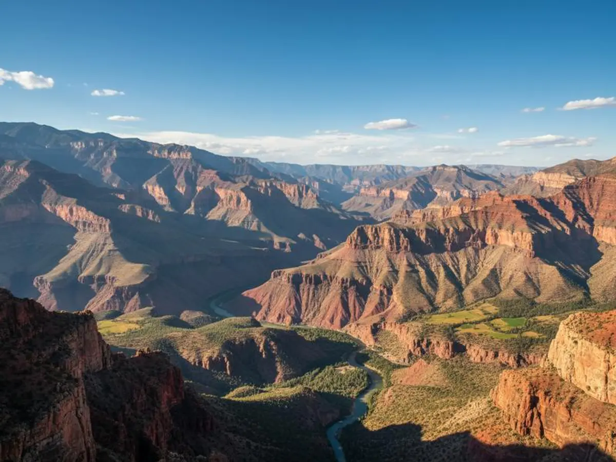
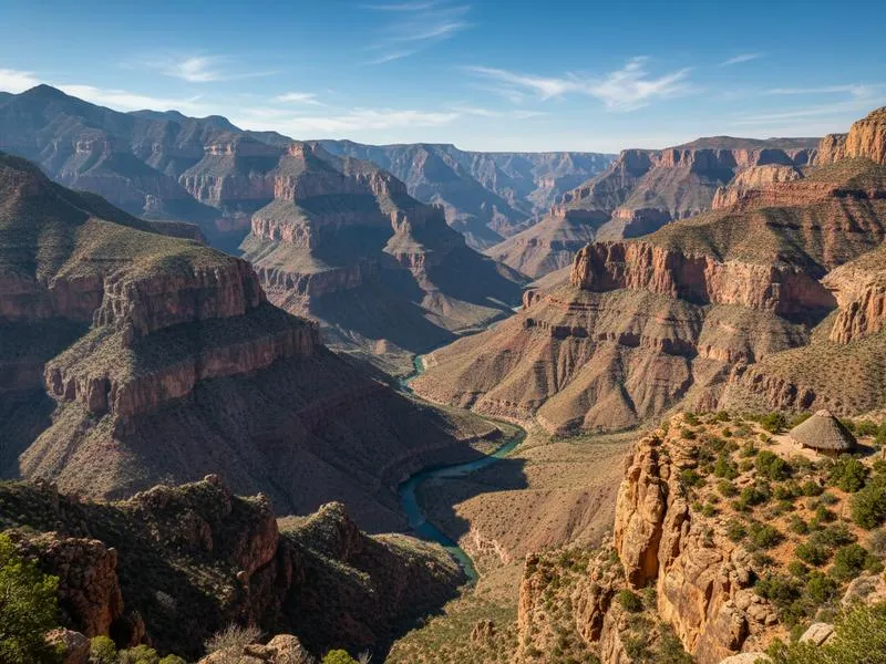
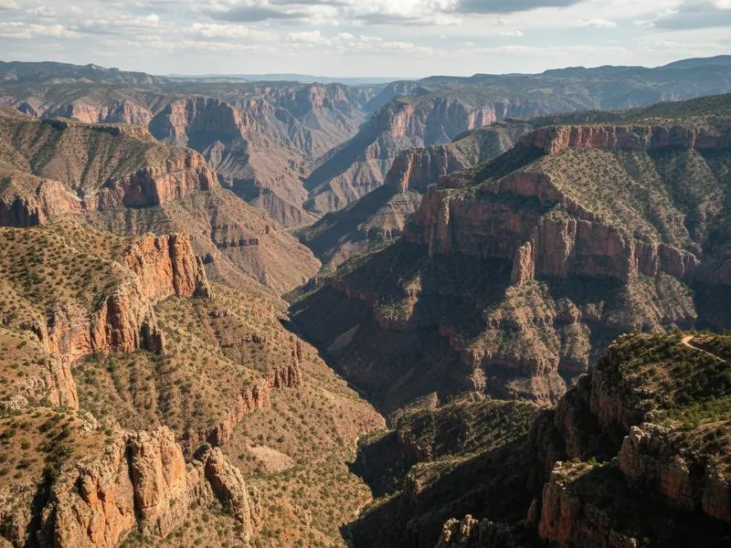
The Copper Canyon system (Barrancas del Cobre) in Chihuahua is a network of six major canyons carved into the Sierra Madre Occidental, covering roughly 65,000 square kilometers, about four times the area of Arizona’s Grand Canyon. At the bottom of Urique Canyon, the deepest of the six, the elevation drops 1,879 meters from rim to canyon floor, and the climate shifts from pine forest at the top to subtropical heat below.
For most first-timers, El Chepe plus local transfers is easier than self-driving the whole canyon. A rental car only makes sense if you are basing in Chihuahua City, Creel, or Los Mochis and want flexibility for nearby viewpoints, waterfalls, and trailheads. If that is your plan, compare CUU or LMM airport rates on RentCars before locking your train dates.
Copper Canyon in 30 Seconds
| Question | Fast answer |
|---|---|
| Is Copper Canyon worth visiting? | Yes, especially if you want a train-and-mountains trip that feels completely different from Mexico’s beach and city circuits. |
| How many days do you need? | 3 days minimum, 5 days is better if you want Creel plus a deeper canyon stop. |
| Where should you stay first? | Creel for most trips, Divisadero for one splurge night on the rim, Cerocahui only if you want the more remote side. |
| Do you need El Chepe? | For a first trip, yes. It is the easiest way to understand the landscape without a complicated self-drive plan. |
| Is Copper Canyon safe right now? | The tourist corridor around Creel, Divisadero, and El Chepe is generally the safest way to visit. |
| Best time to go? | October to November for the easiest weather, December to February if you want a chance of snow. |
Quick Facts
| Location | Sierra Madre Occidental, Chihuahua, Mexico |
| Canyon system | 6 major canyons, ~65,000 km² total |
| Deepest point | Urique Canyon — 1,879 m deep |
| El Chepe route | Chihuahua City → Los Mochis, 653 km |
| Train duration | 15-16 hours full route |
| Base town | Creel, 2,400m elevation |
| Nearest airports | CUU (Chihuahua City) or LMM (Los Mochis) |
| Best time | October–November, December–February (snow) |
| Budget/day | $80–150 USD (train + hotel + food) |
| Safety level | Chihuahua State Level 3 (US); canyon circuit generally safe |
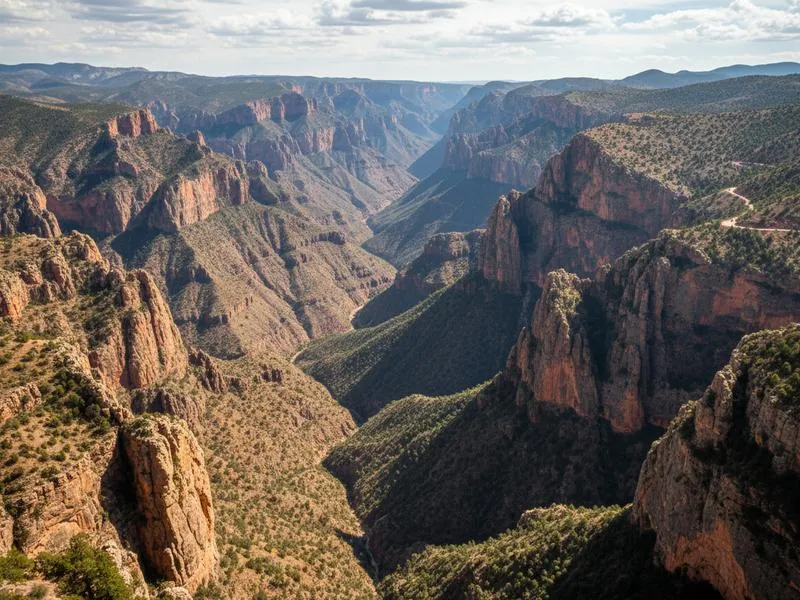
What Makes Copper Canyon Different From the Grand Canyon
Copper Canyon is not the kind of place where you pull up to one viewpoint, take a photo, and move on. The draw is the combination of scale, rail travel, mountain towns, Rarámuri culture, and the huge change in climate and elevation over a relatively short distance.
For most travelers, that means Copper Canyon works best as an itinerary, not just a lookout. If you only want one dramatic canyon panorama, Arizona is easier. If you want a deeper overland Mexico trip with more movement and cultural texture, Copper Canyon is the stronger experience.
Why Copper Canyon Gets Overlooked — and Why That’s Changing
Most English-language travel writing about Mexico clusters around three zones: the Riviera Maya, Mexico City, and Oaxaca. The north gets a fraction of the attention, which means Copper Canyon gets written about mostly by foreign travelers who visited once and stayed three days.
Here’s what those guides miss: this place is genuinely vast. The six canyon system is not a single dramatic gorge you can photograph from a viewpoint and leave — it’s a landscape that takes days to sink into, with different ecosystems stacked on top of each other. Pine and oak forest at the top. Scrub at mid-elevation. Mango trees and sugarcane at the canyon floor, where the temperature runs 20°C warmer.
Rick has covered northern Mexico for years. Copper Canyon ranks among the places where knowing the country from the inside changes the experience. You don’t rush through it.
For context on how this compares to North America’s most famous canyon, see our Copper Canyon vs Grand Canyon breakdown.
Book Copper Canyon tours on Viator — El Chepe train packages, canyon hiking tours, and Rarámuri cultural experiences all available.
El Chepe: The Train That Built the Canyon’s Reputation

The Ferrocarril Chihuahua al Pacífico — El Chepe — is the reason most international visitors come to Copper Canyon at all. The train runs 653 kilometers between Chihuahua City and Los Mochis, crossing 37 bridges and passing through 86 tunnels. It took 90 years to build, with construction starting in 1872 and finishing in 1961. When you ride it, you understand why it took so long.
Our complete El Chepe guide covers schedules, pricing, and every stop in detail. Here’s the strategic overview:
Express vs Regional: Which Class to Take
Two classes operate the Chihuahua–Los Mochis route:
Chepe Express (first class): Daily in each direction. Air-conditioned cars, panoramic windows, restaurant car with Mexican food and bar service. Stops at Creel and Divisadero plus a few others. The comfortable option.
Chepe Regional (economy): Runs Monday, Thursday, and Saturday from each end. Cheaper. Stops everywhere — including small Rarámuri communities that the Express bypasses. Slower, noisier, no restaurant car. The authentic option.
Most international visitors choose Express. If you’re traveling on a budget or want maximum contact with local life, Regional gives you a different experience at about 60% of the price.
How Most People Actually Do It
Riding the full 15-16 hours in one go wastes the scenery (several hours happen at night depending on direction). The standard approach:
Option A (3 days minimum): Fly into Chihuahua City → El Chepe to Creel → 2 nights in Creel → continue to El Fuerte or Los Mochis → fly home from LMM.
Option B (5 days): Same route but add Bahuichivo/Cerocahui overnight for the most remote experience and a canyon descent toward Urique.
Option C (budget): Fly into Los Mochis → El Chepe to Creel and back → fly home from Chihuahua. Works if you’re short on time.
The Creel section (around 3 hours) has the most dramatic scenery per hour. If you can only do one segment, do it.
Key Stops Along El Chepe Route
Chihuahua City
The starting point. Most travelers spend one night here before boarding the morning train. Worth a half-day:
- Pancho Villa Museum (Quinta Luz): Villa’s former home, now a museum with his legendary Dodge Touring Car riddled with bullet holes. Genuinely interesting.
- División del Norte history: Chihuahua was a center of the 1910 Revolution — the city carries that history in its architecture and monuments.
- Cathedral of Chihuahua: 18th-century baroque, facing the main plaza.
For everything you need to know before arriving — including El Chepe station logistics, where to stay, and what to eat — see our Chihuahua City travel guide.
If your interest runs toward other Chihuahua archaeological sites, our Paquimé/Casas Grandes guide covers a UNESCO World Heritage site 3 hours northwest of Chihuahua City.
Creel
Elevation 2,400m. Population ~6,000. The main base for Copper Canyon exploration and the stop most visitors treat as their base.
Creel itself is a functional railroad town — not polished for tourism. The main street has hotels, restaurants, and tour operators within a few blocks. Everything you need, nothing you don’t.
From Creel you can arrange day trips to everything in the surrounding area. Our Creel Chihuahua guide has the full breakdown.
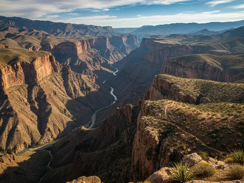
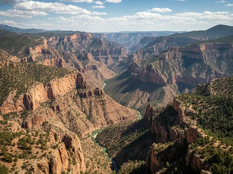
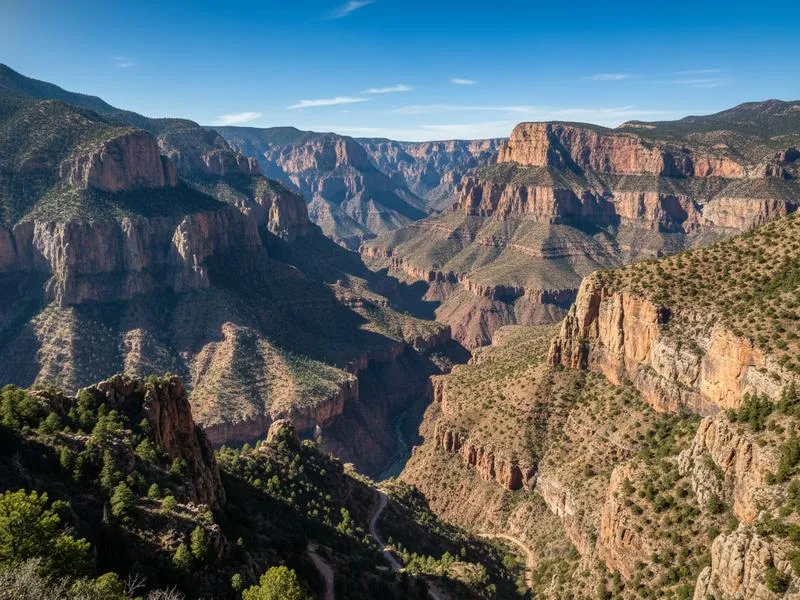
Divisadero
The single most dramatic stop on the route: the train pauses for 15 minutes at a viewpoint directly on the canyon rim. The drop in front of you is approximately 1,300 meters. There’s a cable car (Barrancas del Cobre Adventure Park) if you want to go over the edge.
Several hotels sit right on the rim at Divisadero, and staying overnight gives you the viewpoint at sunrise — entirely different from the midday train stop.
Bahuichivo / Cerocahui
The least-visited and most rewarding stop for travelers who want to move slowly. Bahuichivo is the train station; Cerocahui is a 17th-century Jesuit mission village 10km uphill. From Cerocahui, a dirt road descends toward the town of Urique at the canyon bottom — the deepest point of the entire system.
This is where you leave the tourist circuit. Accommodation is basic, cell service minimal, and the roads require a 4WD. Worth it for the right traveler.
El Fuerte
On the Sinaloa side, near Los Mochis. A colonial town with Spanish-era architecture and a fort overlooking the river. More polished than the canyon stops, with decent boutique hotels. Many travelers spend their last night here before flying home from Los Mochis (LMM).
See our El Fuerte Sinaloa guide for where to eat and stay.
Things to Do Around Creel
Creel is the operational hub. Most day trips run 3-4 hours each and can be done by taxi, tour, or rental vehicle.
Cascada Cusarare: 30 km from Creel. A 30-meter waterfall in a pine canyon. In December and January it sometimes freezes — layers of ice over the falls. Access is a short hike from the road.
Valle de los Hongos (Valley of Mushrooms): 3 km from Creel. A field of eroded volcanic rock formations that look exactly like giant mushrooms. Surreal at any light, spectacular at sunset. Easy walk, no guide needed.
Lago Arareko: 7 km from Creel. A pine forest lake where you can rent rowboats. More tranquil than dramatic — good for an afternoon if you’ve already done the canyon-heavy activities. The shoreline has Rarámuri craft stalls.
San Ignacio de Arareko: A Rarámuri village near the lake. The community sells artisan crafts — carved wood, woven baskets, pine needle baskets. Buying directly here is the most direct economic benefit to the community.
Batopilas: For travelers with 2 extra days, the colonial silver mining town of Batopilas sits at the bottom of its own canyon, a 4-hour drive from Creel on a road with 3,500+ curves. One of the most isolated colonial towns in Mexico.
Compare car rental prices on RentCars if you want to drive the canyon roads yourself — a 4WD is strongly recommended for anything beyond Creel town.
For driving context across Mexico, our driving in Mexico guide covers road conditions, tolls, and insurance.
The Rarámuri (Tarahumara) People
The Rarámuri (their name for themselves; “Tarahumara” is the Spanish colonial term) are one of Mexico’s most intact indigenous cultures. An estimated 50,000-70,000 Rarámuri live in the Sierra Tarahumara, many in traditional canyon communities that have resisted outside influence since the Spanish colonial period.
They became internationally famous outside Mexico after Christopher McDougall’s 2009 book Born to Run, which documented their tradition of ultra-long-distance running — racing in thin leather sandals over canyon terrain for distances of 100+ miles. The Rarámuri have dominated ultra-endurance events when they’ve entered formal races.
Respectful Engagement
The Rarámuri are not a tourist exhibit. Some key points:
- Craft buying: The main form of economic exchange that works. Buy directly from artisans in communities rather than from non-Rarámuri shops reselling their work. Prices are often fixed, not negotiable — don’t haggle with artisans.
- Photography: Always ask. “¿Puedo tomar una foto?” Many will decline politely, especially elders and people at religious sites. Respect that.
- Community visits: Several tour operators run visits to Rarámuri communities. Choose ones run by Rarámuri guides or with explicit community consent and revenue sharing.
- Terminology: Rarámuri prefer their own name to Tarahumara.
The Creel area guide has specific recommendations for community-run tours.
Best Time to Visit Copper Canyon
Copper Canyon has four distinct seasons, and each appeals to a different type of traveler.
October–November (Best overall): Temperatures at the rim average 12-20°C during the day. The rainy season has ended, skies clear, and wildflowers still color the canyonside. This is the sweet spot — comfortable for hiking, no crowds, good light for photography.
December–February (Snow season): Creel at 2,400m gets genuine winter — snow is possible from December through February. The canyon rim covered in snow while the canyon floor sits at 20°C below is visually striking and photogenic. Nights are cold (below freezing). Dress in layers and confirm that your planned activities aren’t closed.
March–May (Shoulder season): Warming up, lower rainfall. Good hiking weather. March is particularly good — the pine forest is green from winter moisture, temperatures are rising, and the crowds haven’t arrived.
June–September (Rainy season): The least recommended period. Afternoon thunderstorms are reliable. The canyon floor becomes extremely humid and hot (40°C+). Trail conditions worsen. Some roads close. July and August in particular make the canyon bottom miserable for casual visitors.
Our best time to visit Mexico guide covers how to time a broader Mexico trip around Copper Canyon.
Getting to Copper Canyon
By air + train (recommended):
Most travelers fly into Chihuahua City (CUU) and board El Chepe the next morning. Aeromexico, Volaris, and VivaAerobus run domestic flights from Mexico City (1.5 hours), Guadalajara, and Monterrey. From the US, there are direct flights from Dallas, Phoenix, and Los Angeles.
Full transport options from CDMX: Mexico City to Chihuahua — flights, overnight bus (Terminal Norte), driving.
Alternatively, fly into Los Mochis (LMM) on the Sinaloa coast and ride east into the canyon — good if you’re combining with Pacific coast beach time.
By road from Chihuahua City to Creel:
260 km west of Chihuahua City on a paved highway (about 3.5 hours). The road goes through the towns of Cuauhtémoc and La Junta. Driving gives you flexibility to detour to sites the train misses, but you’ll need to arrange transport or rental at each train stop.
Compare rental prices on RentCars for the Chihuahua-to-Creel drive option.
Where to Stay
Creel
Hotel Margaritas: The most established mid-range option in Creel. Clean, reliable, with in-house tour booking and a good restaurant. Rates around $40-70/night. Books up fast in October-November.
Posada Barrancas Hotel Mirador (at Divisadero): If you want to sleep on the canyon rim rather than in Creel, this hotel sits directly above the viewpoint. Sunrise from the terrace is one of the better experiences the region offers. Rates $80-130/night.
Budget options in Creel: Several basic posadas run $15-25/night. Adequate for budget travelers spending most of their time outside anyway.
El Fuerte
If you’re ending your trip on the Los Mochis side, El Fuerte has better accommodation options than Los Mochis itself. Posada del Hidalgo (a colonial mansion hotel) is a step up from anything in Creel — rates $70-120/night.
Copper Canyon vs Grand Canyon
Both are world-class canyon experiences. They are not comparable experiences:
| Copper Canyon | Grand Canyon | |
|---|---|---|
| Total area | ~65,000 km² (6 canyons) | ~4,926 km² |
| Deepest point | 1,879 m (Urique Canyon) | 1,600 m |
| Crowds | Low to moderate | Very high (6M visitors/year) |
| Main access | Train + dirt roads | Paved roads, shuttle buses |
| Indigenous culture | Rarámuri communities, active | Havasupai, limited access |
| Infrastructure | Basic to moderate | Excellent |
| Cost | $80-150/day | $150-250+/day |
| Difficulty | Higher (logistics, road quality) | Easier |
Grand Canyon is easier and more accessible. Copper Canyon is bigger, less crowded, cheaper, and offers a living indigenous culture that the Grand Canyon experience doesn’t include.
More detail in our Copper Canyon vs Grand Canyon comparison.
Safety: The Honest Picture
Chihuahua State carries a US Level 3 travel advisory (“Reconsider travel”). This needs context.
The Level 3 designation applies primarily to border cities (Ciudad Juárez) and certain highway corridors used by drug trafficking organizations. The canyon region — Creel, Divisadero, Bahuichivo, the El Chepe corridor — has operated without significant tourist incidents for decades.
Thousands of international travelers visit annually. The main tourist circuit is isolated from the areas that generate the Level 3 rating.
Practical safety approach:
- Fly directly into Chihuahua City — don’t drive from the US border
- Board El Chepe and stay on the tourist circuit
- In Creel, use recommended local guides for canyon descents
- Don’t drive unfamiliar roads at night, especially off the main highway
- Register your trip with your country’s embassy if concerned
For broader Mexico safety context, the northern Mexico travel guide covers what Level 3 actually means in practice across different regions. For a detailed safety breakdown of the canyon corridor, El Chepe, and Creel, see Is Copper Canyon Safe?.
Budget Planning
Copper Canyon is one of the most affordable dramatic landscape experiences in North America.
| Expense | Budget | Mid-range |
|---|---|---|
| El Chepe (one-way, full route) | $25-40 (Regional) | $60-90 (Express) |
| Accommodation/night (Creel) | $15-25 | $40-70 |
| Meals/day | $10-20 | $25-40 |
| Day trip activities | $10-20 | $30-60 |
| Total/day | $60-105 | $155-260 |
The biggest variable is the train ticket. Express first class for the full route costs around $85-90 USD. Regional is about $50-55. If you’re only doing the Creel segment (3-4 hours), costs drop significantly.
See our Mexico travel budget by region guide for how Chihuahua compares to other parts of the country.
Suggested Itineraries
3-Day Copper Canyon (Minimum)
Day 1: Fly into Chihuahua City. Afternoon at Pancho Villa Museum and cathedral. Overnight in Chihuahua.
Day 2: Board El Chepe Express morning (departs ~7:30 AM). Arrive Creel early afternoon. Check in, walk Valle de los Hongos at sunset.
Day 3: Day trip from Creel — Cascada Cusarare in the morning, Lago Arareko + Valle de los Hongos in afternoon. Craft shopping at San Ignacio. Evening return train or fly from Chihuahua the next morning.
5-Day Copper Canyon (Recommended)
Day 1: Chihuahua City arrival, Pancho Villa Museum. Day 2: El Chepe to Creel. Check in. Day 3: Full day around Creel — Cusarare falls, mushroom valley, lake. Day 4: Train from Creel to Divisadero (2 hrs). Rim viewpoint, cable car. Overnight on the rim. Day 5: Continue on El Chepe to El Fuerte. Overnight, then fly from Los Mochis.
This 5-day version fits naturally into our 10-day Mexico itinerary if you’re combining with another region — Oaxaca and Copper Canyon make a particularly good two-part trip.
See also: Mexico 2-week itinerary for pairing Copper Canyon with Baja or the Pacific coast.
Combining Copper Canyon with Other Destinations
Copper Canyon + Baja California: Fly into Los Mochis, ride El Chepe east to Chihuahua, fly to La Paz or Loreto for the Sea of Cortez. See Baja California Sur best places.
Copper Canyon + Colonial Highlands: Fly in and out of Chihuahua. Day-trip to Casas Grandes/Paquimé (UNESCO site, 3 hrs northwest) or Guachochi for a second canyon viewpoint. See also the colonial Mexico travel guide.
Practical Tips Before You Go
Booking El Chepe: Reserve seats at least 2-3 weeks ahead for October-November travel. The official Chepe website sells tickets online. Tickets in high season sell out.
Cash: Creel has one ATM, and it runs out of cash regularly. Bring pesos from Chihuahua City. Most restaurants and hotels don’t take cards reliably.
Altitude: Creel at 2,400m. If you’re sensitive to altitude (coming from sea level), allow a day to adjust before doing strenuous hikes. Mild headaches and fatigue are common the first 24 hours.
Cell service: Spotty in Creel, non-existent at Bahuichivo and on the canyon descent to Urique. Download offline maps before you go.
Language: English is spoken in tourist hotels and tour operators in Creel. Minimal English elsewhere. Basic Spanish makes the trip significantly easier.
Photography: The best light on the canyon is late afternoon (4-6 PM). The Divisadero viewpoint faces west — sunset timing is worth planning around.
Final Perspective
Copper Canyon doesn’t have great marketing. It doesn’t have an airport in the middle of it, or a shuttle bus every 15 minutes, or a visitor center with a gift shop. Getting there requires a plan, a train ride, and some tolerance for imperfection.
That’s also why it rewards the effort. The Rarámuri have lived in these canyons for centuries. The landscape absorbs the few thousand annual visitors without changing. The train crosses bridges that took engineers decades to solve.
It’s the kind of place that doesn’t feel optional once you’ve been. If you’re planning a northern Mexico trip, check the full northern Mexico guide for how to structure the broader region — Copper Canyon fits naturally alongside Chihuahuan Desert routes and Sinaloa coast time.
Creel activity planning: The Things to Do in Creel guide covers all 20 activities with costs, timing, and how to combine them — Valle de los Hongos, Recowata hot springs, Basaseachi Falls, Rarámuri craft market, and more.