Baja California Travel Guide: Tijuana to Cabo
For a first Baja California trip, the key choice is whether to fly into Los Cabos or La Paz for beaches and Sea of Cortez day trips, or drive the full Tijuana-to-Cabo route over 7-10 days with stops in Ensenada, Guerrero Negro, Loreto, La Paz, and Cabo. Winter brings gray whales; spring and fall are best for road trips; summer is brutally hot away from the coast.
The Baja California Peninsula extends 1,247 km south from the US border into the Pacific, with desert mountains, cactus forest, Pacific surf, and the Sea of Cortez on the east side. The big decisions are route, season, and pace: wine country near Ensenada, whale lagoons around Guerrero Negro and San Ignacio, Balandra Beach near La Paz, and Los Cabos at the southern tip all reward different trip styles.
This guide covers the full length of the peninsula, from Tijuana and Ensenada through the remote center to Loreto, La Paz, and Cabo, so you can build the Baja trip that fits your time, driving comfort, and beach priorities.
The Two Californias: Understanding the Peninsula
The peninsula is divided into two Mexican states:
Baja California (Norte): The northern state. Tijuana is the border city (world’s busiest land crossing). Ensenada is the wine country gateway, 80 km south. Mexicali is the state capital — inland, hot, not a tourist destination. The Valle de Guadalupe wine region (30 km from Ensenada) has become Mexico’s Napa Valley equivalent.
Baja California Sur: The southern state. La Paz is the underrated capital. Loreto is a colonial town and sport fishing base. Los Cabos is the resort destination — specifically Cabo San Lucas (party end) and San José del Cabo (quieter, more authentic). The two are connected by the 30 km Tourist Corridor.
Ensenada and Valle de Guadalupe
Ensenada, 80 km south of Tijuana, is the northern Baja gateway. It’s a working port city with a historic downtown, good seafood, and the start of Mexico’s premier wine region 30 km inland.
Valle de Guadalupe
Mexico’s wine industry centered here because the Valle de Guadalupe’s combination of coastal fog, volcanic soil, and warm dry summers produces conditions similar to parts of Napa and Bordeaux. The valley is producing red blends, tempranillo, grenache, and whites from chenin blanc that are attracting serious attention internationally.
The wine scene has evolved beyond wineries into a full culinary destination: restaurants like Laja, Corazón de Tierra, and dozens of others operate amid the vines, offering tasting menus that use produce from the surrounding valley. The annual Fiestas de la Vendimia (harvest festival) in August draws visitors from across Mexico.
Logistics: rent a car or join a tour from Ensenada (half-day or full-day tours start around 800–1,200 MXN). Most wineries open for tastings Thursday–Sunday; some require reservations.
Ensenada itself
The waterfront Malecón is pleasant; La Bufadora (a dramatic blowhole 30 km south) is worth an afternoon. The fish taco stands on Calle Primero are Baja classics — the style of battered, fried fish in a warm tortilla with cabbage and crema was popularized here.

Guerrero Negro and Gray Whales
Guerrero Negro sits on the 28th parallel — the border between Baja California Norte and Sur — and is the primary town for the whale watching lagoons. Every January through March, the San Ignacio Lagoon (2 hours further south) and Ojo de Liebre Lagoon near town host thousands of Pacific gray whales that migrated from Alaska to breed in Baja’s warm protected waters.
The “Friendly Whale” Phenomenon
San Ignacio Lagoon is world-famous for a behavior that happens nowhere else: wild gray whales actively approach small fishing boats and present themselves to be touched. Whale cows bring their calves to the boats. People reach over the side and pet a whale. It’s not trained, not baited — biologists still debate why it happens, but it’s been consistent for decades.
Access: organized tours from Guerrero Negro or directly through eco-camps at San Ignacio Lagoon (advance booking essential January–March). Cost: approximately 1,200–2,000 MXN per person for a 3-hour panga trip.
Season: December–April for gray whales generally. January–March for “friendly” encounters and best activity.
Loreto: The Original Baja Capital
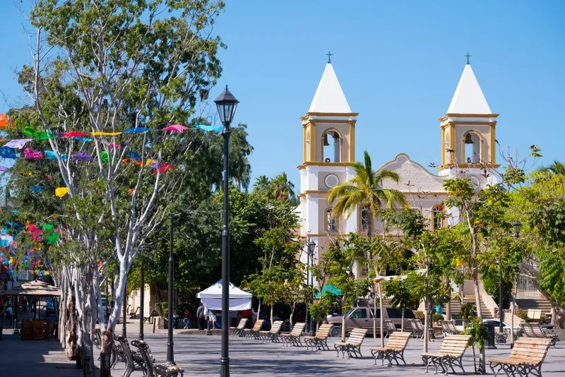
Loreto is the oldest permanent settlement on the peninsula — the first Jesuit mission was established here in 1697, making it Baja California’s colonial origin point. Today it’s a small, calm bay town of around 20,000 people with an excellent beach and a strong sport fishing reputation.
The Misión Nuestra Señora de Loreto is the oldest active mission church in the Californias. The adjacent museum holds artifacts from the mission period.
Offshore, Loreto Bay Marine Reserve covers five islands and the surrounding sea — excellent snorkeling, diving, sea kayaking, and whale watching (blue whales pass during winter). Puerto Escondido, 25 km south, offers mooring for sailboats and access to wild beaches.
Loreto has fewer than 20 hotels and practically no nightlife. It’s a destination for people who want fishing, kayaking, and isolation rather than resorts. Flights from Tijuana and LA are available (Loreto International Airport, LTO).
La Paz: The Real Baja Capital
La Paz is the city Cabo San Lucas travelers don’t bother with — which makes it the best reason to go. The state capital sits on a protected bay where the Sea of Cortez is at its most vivid turquoise. The waterfront Malecón is 5 km of seaside promenade where Paceños walk, cycle, and eat fish tacos at sunset.
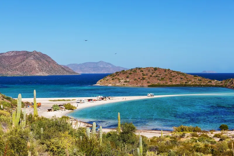
Balandra Beach
Balandra is frequently ranked among Mexico’s most beautiful beaches — and the rankings are correct. A shallow lagoon of almost impossibly clear turquoise water, sheltered by a horseshoe-shaped cove, with the desert hills of the peninsula rising behind. The water at the center is waist-deep even when you’ve waded 200 meters from shore. It feels like the Caribbean but quieter.
Entry is free but regulated — 4,500 visitors maximum per day, no commercial food vendors inside. Take your own water and snacks. Arrive early; it fills up.

Wildlife in La Paz
The waters around La Paz offer marine wildlife encounters that Los Cabos charges premium prices for:
Sea lions at Los Islotes: A sea lion colony on a rocky island 45 minutes by boat from La Paz. Snorkeling with them is included in most La Paz day tours. The sea lions are curious and playful — younger ones will swim directly up to you.
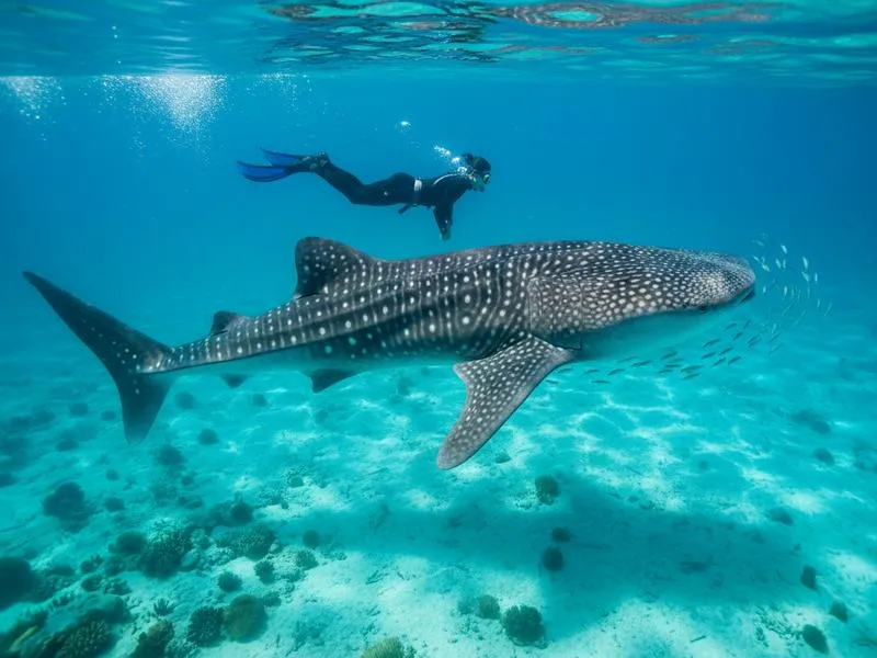
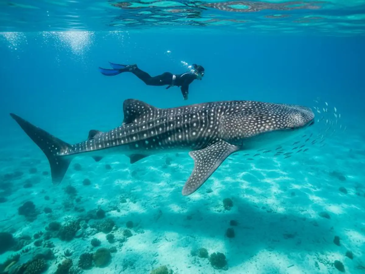
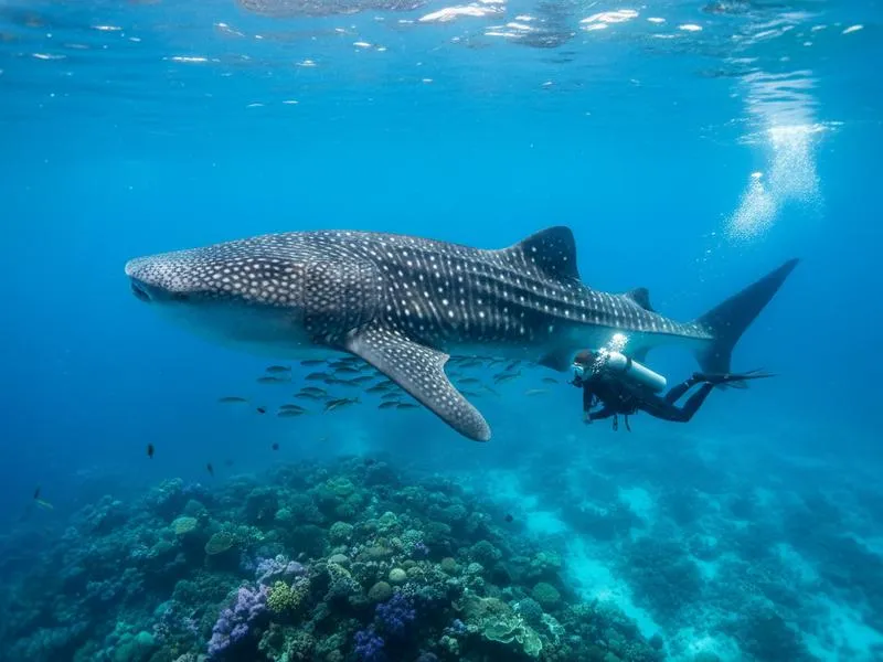
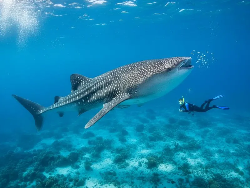
Whale sharks (October–April): La Paz Bay is one of the most reliable places in the world to swim with whale sharks. These gentle filter-feeders (up to 12 meters) congregate in the bay’s warm waters during cooler months. Tours from La Paz waterfront (around 1,200–1,500 MXN) include transport and snorkel gear.
Blue whale watching (January–March): La Paz and Loreto are key areas for blue whale sightings — the largest animal ever to have lived migrates through the Sea of Cortez in winter.
La Paz Food: Chocolate Clams and More
La Paz’s specialty seafood item is the almeja chocolata — large chocolate-brown clams farmed in the bay, eaten raw with lime and salsa or baked with cheese. Every La Paz restaurant worth visiting does a version. The waterfront area has excellent ceviche, fish tacos, and marlin tostadas.
For more: La Paz Travel Guide | Things to Do in La Paz
Los Cabos: The Southern Tip
Los Cabos is two towns sharing a 30 km Tourist Corridor:
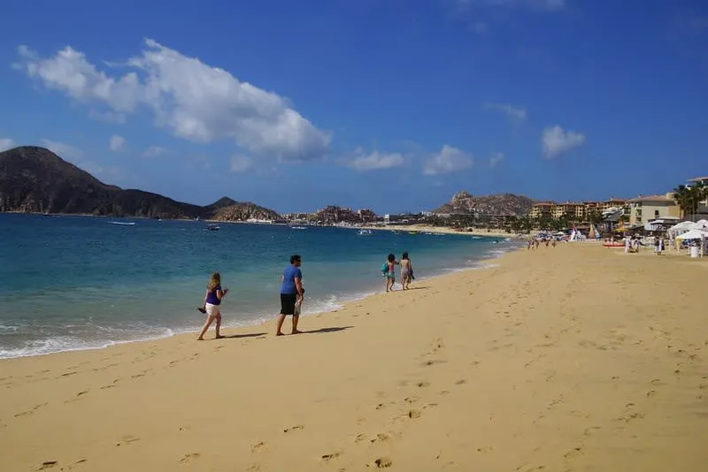
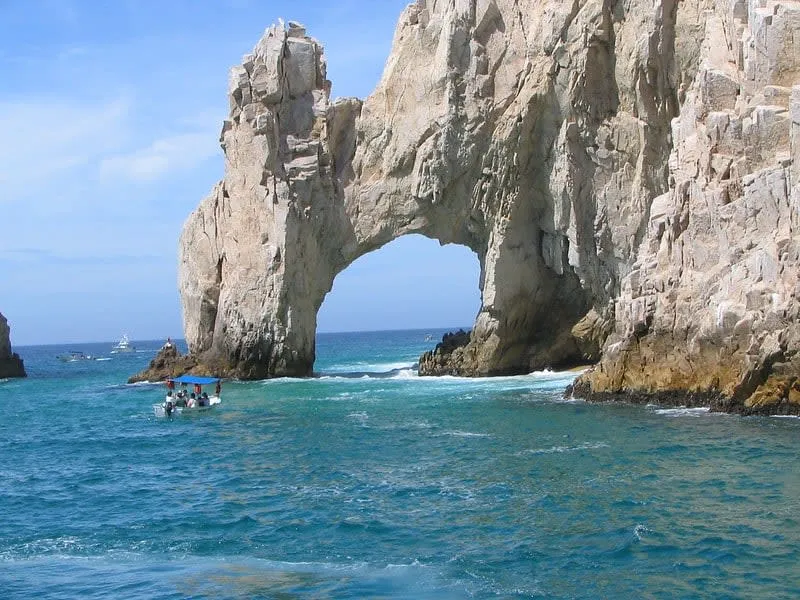
Cabo San Lucas is the party end — a large marina, nightclubs, all-inclusive resorts, and The Arch (El Arco), the sea stack formation where the Pacific and Sea of Cortez technically meet. Médano Beach is the main swimming beach (the only safe-to-swim spot near Cabo town). Lover’s Beach, accessible only by water taxi, sits just below The Arch with dramatic rock formations.
San José del Cabo is the quieter end — a proper colonial Mexican town with a missions church, gallery district, and a wider variety of genuinely good restaurants. The San José estuary (a protected bird lagoon at the beach) is excellent for birdwatching. The Thursday Art Walk through the gallery district is worth planning around.

The Tourist Corridor between the two towns has the main resort strip — large all-inclusive hotels on beaches inaccessible without hotel access (strong Pacific currents make most of the corridor beaches dangerous for swimming). The exceptions are Palmilla Beach and a few others.
For specific Los Cabos planning: Los Cabos Travel Guide
Safety in Baja California
Baja California Norte (Tijuana, Ensenada): Tijuana has specific high-risk neighborhoods. The tourist zones (Zona Río, Avenida Revolución, Plaza Fiesta) are safer. Ensenada is considered low-risk. Valle de Guadalupe is fine. Don’t drive at night on unfamiliar routes in Tijuana.
Baja California Sur (La Paz, Loreto, Los Cabos): Generally safer. Los Cabos and La Paz are heavily visited tourist destinations with strong police presence. The U.S. State Department rates Baja California Sur at Level 2.
The Transpeninsular Highway: MEX-1 is paved and generally safe during daylight. Drive only in daylight — animals on the road, occasional hazards, and poor lighting make night driving risky. Carry water, a basic toolkit, and know that cell service disappears in remote central sections. Gas stations are spaced but present.
Speed bumps (topes): Baja Mexico’s speed enforcement is mostly via topes — severe speed bumps that will destroy your car if hit at speed. Slow dramatically for every town.
Getting to Baja California
By air (Los Cabos): Los Cabos International Airport (SJD) is the main entry point for Baja California Sur — direct international flights from Los Angeles, Phoenix, Houston, Dallas, Denver, and most major US cities. Also from Mexico City (2 hours, from around 800 MXN on budget carriers).
By air (La Paz): Manuel Márquez de León International Airport (LAP) — direct flights from Mexico City, Tijuana, and Los Angeles. Fewer options than Los Cabos but significantly less crowded on arrival.
By ferry from Mazatlán or Topolobampo: Baja Ferries operates passenger and vehicle ferries from the mainland. Mazatlán–La Paz (10 hours overnight), Topolobampo–La Paz (7 hours). Useful if driving the full Baja road trip.
By car from the US border: Cross at Tijuana (San Diego border) and drive south on MEX-1. The full peninsula is 1,700 km to Cabo. Buy Mexican auto insurance before crossing — mandatory and cheap at the border.
Budget Guide
Los Cabos is Mexico’s most expensive resort destination. La Paz and Ensenada offer the same scenery for significantly less.
| Area | Budget/night | Mid-Range/night | All-Inclusive/night |
|---|---|---|---|
| Los Cabos | 800–1,200 MXN | 2,000–4,000 MXN | 3,500–9,000 MXN |
| La Paz | 400–700 MXN | 1,200–2,500 MXN | — |
| Ensenada | 400–800 MXN | 1,000–2,000 MXN | — |
| Loreto | 500–900 MXN | 1,500–3,000 MXN | — |
Daily budget in La Paz: Budget traveler 700–1,000 MXN/day. In Los Cabos resorts: budget matters less; a standard mid-range day runs 2,000–3,500 MXN.
Best Time to Visit Baja
October–April: Best weather on the entire peninsula. Temperatures 22–28°C, low humidity, clear skies. Peak whale shark season in La Paz (October–April). Gray whale season (December–April). Best diving and snorkeling visibility.
January–March: Gray whale “friendly” encounters at San Ignacio Lagoon. Best La Paz whale shark density. Cooler evenings.
June–September: Hot (35–40°C in inland areas). Hurricane season peaks July–October for the Pacific side and particularly the Los Cabos tip. El Niño years bring stronger activity. Prices drop 30–50% off peak.
November–December: Pleasant shoulder season. Crowds building toward Christmas/New Year peak in Los Cabos. Good deals in October–November.
For more context: Best Time to Visit Baja California