Best Road Trips in Mexico 2026: Routes, Tips & Safety Guide
Mexico’s road trip potential is one of the country’s best-kept secrets from international travelers. While most visitors fly between Cancún, Mexico City, and Los Cabos, the overland routes between them deliver something no flight captures — the gradual shift in landscape, food, and culture across one of the most geographically diverse countries on earth.
The infrastructure on Mexico’s main toll highways (autopistas de cuota) is genuinely good. Well-paved, regularly patrolled, with gas stations, roadside fondas, and rest areas at reasonable intervals. The challenge is knowing which roads to take, which to avoid, and how to navigate the practical specifics of driving in Mexico.
This guide covers six specific road trip routes with realistic planning details — distance, days, difficulty, toll costs, and safety notes. For general driving rules, insurance requirements, and practical driving information, see our complete guide to driving in Mexico.
Why Road Trips Work in Mexico
The Infrastructure Is Better Than You Think
Mexico has over 9,000 kilometers of toll autopistas connecting major cities. These roads are 4-lane divided highways with regular maintenance, emergency phones, and Ángeles Verdes (Green Angels) — government-funded roadside assistance trucks that patrol them for free.
The toll autopistas bypass free federal highways (carreteras federales) which are two-lane roads through towns, sometimes in poor condition, and which take significantly longer. The toll difference — anywhere from 100 MXN to 400 MXN for a segment — is almost always worth paying.
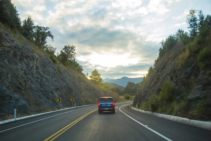
Self-Driving Unlocks Unreachable Places
Mexico’s bus network is excellent for city-to-city travel but doesn’t reach the 50km detour to a remote hacienda, the back road to the best cenote in Yucatán, or the high-altitude mountain drive through Oaxaca’s valley. Renting a car for a specific leg of a trip — even if you take buses everywhere else — changes what’s accessible.
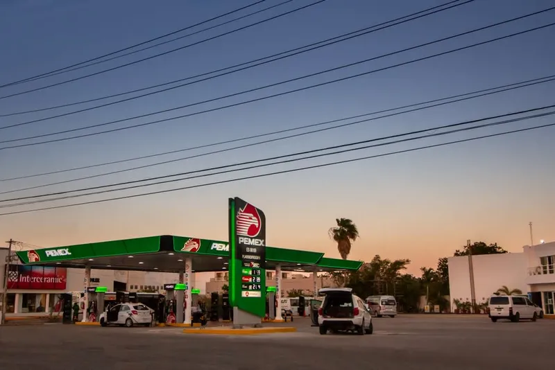
Gas and Fueling
PEMEX is Mexico’s state oil company and operates virtually all gas stations. Prices are uniform nationwide (set by the government). Modern PEMEX stations accept cards; older or rural stations may be cash only. Carry MXN cash as a backup. OXXO convenience stores at PEMEX stations accept cards reliably.
Use regular (Magna, green handle) or premium (Premium, red handle) unleaded. Most rental cars require regular. Diesel (black handle) is available but not recommended unless your rental specifies it.
Route 1: Baja Sur Loop
La Paz → Todos Santos → Cabo San Lucas → San José del Cabo → East Cape → La Paz
-
Distance: ~600 km
-
Days: 4-5 days
-
Difficulty: Easy to moderate
-
Best season: October to May
-
Approximate tolls: Minimal (under 200 MXN total)

The Baja Sur loop is Mexico’s most visually dramatic road trip — the Transpeninsular Highway (Mexico 1) runs through desert-meets-sea landscapes that belong in a cinematography reel. Cacti, whale-watching bays, turquoise water, and fishing villages in rapid succession.
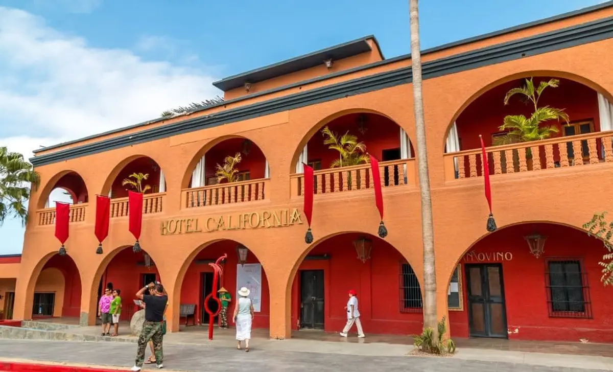
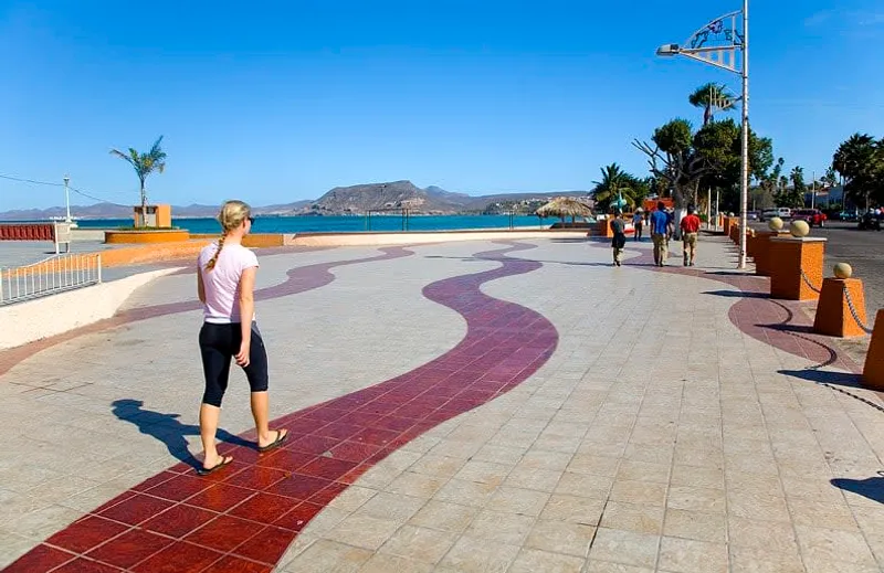
The route: Start in La Paz (the natural base for Baja Sur — better value than Cabo, ferry connections to mainland). Drive south on Mexico 1 to Todos Santos, an art-world town with good coffee shops and a famous hotel (the “Hotel California,” though not the Eagles one). Continue to Cabo San Lucas for the famous Los Arcos arch and marina. Eastward to San José del Cabo — more low-key than Cabo, with a worthwhile art district. Then north along the East Cape (the undeveloped Pacific side, dramatically beautiful) back to La Paz.
Highlights: Whale watching in Bahía Magdalena (January-March), sea lion colony at Los Islotes near La Paz, kite surfing at Los Barriles, and the wine region around Todos Santos.
Practical notes: Baja Sur roads are in good condition. The East Cape stretch (Cabo Pulmo to La Paz) is narrower and less maintained — take it slow and in daylight. Rental cars in La Paz give you the most flexibility (avoid Cabo airport rentals). See our Los Cabos guide for Cabo accommodation options.
Toll estimate: Under 200 MXN total. The Transpeninsular has minimal toll booths compared to mainland Mexico.
Route 2: Oaxaca Valley Circuit
Oaxaca City → Monte Albán → Tlacolula → Mitla → Hierve el Agua → Santiago Matatlan → Oaxaca City
- Distance: ~120 km loop
- Days: 2 days
- Difficulty: Easy
- Best season: Year-round (avoid August rainy season for Hierve el Agua)
- Approximate tolls: Under 100 MXN
The Oaxaca Valley circuit is one of the best short road trips in Mexico — dense with Zapotec history, mezcal production, and one of the most surreal geological formations on earth.
Day 1: Drive west to Monte Albán (ruins on a hilltop with 360° valley views), then east through the Tlacolula market town to Mitla (the most intact Zapotec palace complex in existence, with distinctive stone mosaic friezes). Sleep in Oaxaca or in Tlacolula.
Day 2: Head south through Santiago Matatlan (mezcal capital of the world — stop for a palenque visit) to Hierve el Agua — petrified waterfalls and mineral infinity pools on a cliff edge with valley views. Return to Oaxaca City via any route.
Practical notes: All roads on this circuit are paved and in reasonable condition. Hierve el Agua road is narrow and winding — fine in a standard car, take care in rainy months. No tolls on most of this circuit — the roads are state-maintained rather than toll autopistas. Read our Oaxaca travel guide for accommodation in Oaxaca City.
Toll estimate: 50-100 MXN if using any short autopista segments.
Route 3: Yucatan Peninsula Loop
Cancún → Valladolid → Chichen Itza → Mérida → Campeche → Bacalar → Tulum → Cancún
- Distance: ~1,200 km
- Days: 7-10 days
- Difficulty: Easy
- Best season: November to April (dry season)
- Approximate tolls: 1,200-1,500 MXN
The Yucatan Peninsula loop is Mexico’s most complete road trip — it combines the most accessible Maya ruins, Mexico’s most beautifully preserved colonial city (Mérida), a UNESCO walled city (Campeche), the seven-color Bacalar lagoon, and Caribbean beach access in a single continuous circuit.
The route: From Cancún, drive west to Valladolid (colonial city, cenote Zací, excellent food) for one night. West to Chichen Itza (arrive early — see photography guide above), then to Mérida for 2-3 nights. South to Campeche (underrated — stay a night in the walled old city). South to Bacalar (the lagoon that justifies the trip). North to Tulum (the Instagram ruins, actually impressive from inside despite the crowds). Coast road back to Cancún.
Highlights per segment: Valladolid cenotes (three within 10 km), Chichen Itza at sunrise, Mérida’s Sunday market and hacienda circuit, Campeche’s fortified walls and seafood, Bacalar’s colors at 6am from a kayak, and Tulum’s cliffside ruins over the Caribbean.
Practical notes: The Mérida-to-Campeche and Campeche-to-Chetumal segments are less trafficked and excellent driving. ADO-quality highways throughout. The Tulum area has some road construction ongoing in 2026 (the new Maya Train expansion). Toll roads connect all major segments — use them. See our Yucatan itinerary guide for day-by-day planning.
Toll estimate: 1,200-1,500 MXN total for the full loop. The Cancún-Mérida autopista segment alone is around 400 MXN.
Route 4: Copper Canyon Road
Chihuahua → Creel → Divisadero → Batopilas
-
Distance: ~300 km one-way
-
Days: 3 days minimum
-
Difficulty: Challenging (mountain roads, altitude)
-
Best season: April-June, September-October
-
Approximate tolls: Under 200 MXN (limited autopista access)
This is Mexico’s most challenging road trip — and its most rewarding in terms of landscape. The drive from Chihuahua down into the Sierra Tarahumara and eventually to the canyon floor at Batopilas (a silver colonial town unchanged since the 18th century) is a genuine adventure.
The route: Chihuahua city to Creel (the main Copper Canyon base town, 300km, mostly highway). From Creel, drive to Divisadero (the classic viewpoint). The descent to Batopilas is 60 km of switchback mountain road — unpaved in sections, extremely steep. Take 3-4 hours for those 60km.
Practical notes: The Chihuahua-Creel highway is straightforward. The Creel-Divisadero section is fine in any car. The Divisadero-Batopilas road requires a vehicle with good clearance and reliable brakes — check your rental car agreement, as some exclude unpaved roads.
The El Chepe alternative: The El Chepe train runs from Chihuahua to Los Mochis through the Copper Canyon and is one of the great rail journeys in Latin America. Some travelers drive to Creel, park, take the train to Divisadero and El Fuerte, and return. This hybrid approach uses the car for flexibility and the train for the most dramatic canyon scenery.
Toll estimate: Under 200 MXN — most of this route is federal highway or unpaved, not autopista.
See our Copper Canyon guide for logistics at the canyon floor.
Route 5: Pacific Coast — Mexico City to Puerto Escondido
CDMX → Cuernavaca → Taxco → Guerrero Coast → Puerto Escondido
- Distance: ~500 km (direct) to ~700 km (via coast)
- Days: 4-5 days
- Difficulty: Moderate
- Best season: November to May
- Approximate tolls: 600-800 MXN
The new Oaxaca highway (Autopista del Sol extended to the coast) transformed this route from a 12-hour ordeal to a manageable 6-7 hour drive. The result is one of Mexico’s newest great road trips.
The route: From CDMX south through Cuernavaca (weekend gateway for capitalinos, good food stop) to Taxco — the silver colonial city on a hillside with one of Mexico’s most dramatic plazas. From Taxco, pick up the autopista west through Guerrero state to the Pacific coast, then east along the coast to Puerto Escondido.
Highlights: Taxco’s silver market and Santa Prisca church, the Balsas River canyon on the descent to the coast, the Pacific coast roadside seafood stands, and Puerto Escondido’s Zicatela surf break and fish tacos.
Practical notes: The Guerrero coast segment requires current research before driving — this state has had security advisories in past years. Verify current conditions before the trip (US State Department, UK FCDO, and travel forums all have current info). The drive is fine in daylight on the toll autopista. Avoid driving the coast road at night.
Toll estimate: 600-800 MXN via the full autopista route from CDMX to Puerto Escondido.
Route 6: Colonial Highlands Loop
CDMX → Querétaro → San Miguel de Allende → Guanajuato → Morelia → Pátzcuaro → CDMX
-
Distance: ~850 km loop
-
Days: 7 days
-
Difficulty: Easy
-
Best season: Year-round (Day of the Dead in October-November is spectacular in Pátzcuaro)
-
Approximate tolls: 800-1,000 MXN
The Colonial Highlands loop through the Bajío region (Mexico’s agricultural and industrial heartland) delivers five of the most beautiful colonial cities in the country in a single loop from CDMX. All on excellent roads, all historically significant, all with distinct personalities.
The route: Drive north from CDMX to Querétaro (1.5 hours, architecturally underrated, excellent carnitas). East to San Miguel de Allende (international art scene, Rosewood hotel, world-famous sunsets over the Parroquia church). West to Guanajuato (university city, colored alleys, best street food in the Bajío). South to Morelia (Michoacán’s capital, UNESCO colonial center, exceptional cathedral). West to Pátzcuaro (Day of the Dead ground zero, Janitzio island, indigenous Purépecha crafts). Return to CDMX via the toll autopista.
Highlights: Guanajuato’s callejón del beso, the Morelia aqueduct at night, Pátzcuaro’s Plaza Vasco de Quiroga, and the drive between San Miguel and Guanajuato through the Bajío mountains.
Practical notes: All roads on this circuit are well-maintained toll autopistas or federal highways in good condition. The entire loop is safe for night driving if necessary, though daytime is preferable. The CDMX-Querétaro autopista (México 57D) is one of Mexico’s busiest and best-maintained highways.
Toll estimate: 800-1,000 MXN for the full loop, depending on exact routing.
Route Comparison
| Route | Distance | Days | Difficulty | Best Season | Toll Estimate (MXN) |
|---|---|---|---|---|---|
| Baja Sur Loop | 600 km | 4-5 | Easy-Moderate | Oct-May | Under 200 |
| Oaxaca Valley Circuit | 120 km | 2 | Easy | Year-round | Under 100 |
| Yucatan Peninsula Loop | 1,200 km | 7-10 | Easy | Nov-Apr | 1,200-1,500 |
| Copper Canyon Road | 300 km | 3+ | Challenging | Apr-Jun, Sep-Oct | Under 200 |
| CDMX to Puerto Escondido | 500-700 km | 4-5 | Moderate | Nov-May | 600-800 |
| Colonial Highlands Loop | 850 km | 7 | Easy | Year-round | 800-1,000 |
Rental Car Tips: Mexico-Specific
Skip the Airport
Airport rental desks at Cancún, Los Cabos, and CDMX charge airport surcharges of 20-40%. The same car from the same company at a downtown location costs significantly less. Take a shuttle or taxi to your hotel on arrival night, then rent from downtown the next morning.
Use RentCars to compare prices across companies — the price difference between airport and downtown pickup is often clearly visible on comparison searches.
Insurance and Deductible Waivers
Mexican law requires Mexican auto insurance — your home country policy does not apply. Rental companies include mandatory Mexican liability insurance in all quotes. The variable is the collision damage waiver (CDW):
- The rental company’s CDW eliminates or reduces your deductible if the car is damaged
- CDW from rental companies: 200-500 MXN/day
- Declining CDW means you’re personally liable for the full deductible if damaged (often 20,000-50,000 MXN)
- Some premium credit cards offer CDW coverage for Mexico rentals — check your card before traveling
OXXO Fueling
OXXO stores are everywhere and almost always have a PEMEX pump nearby. For cards, pay at the OXXO cashier for the amount you want, then go to the pump — this is the standard prepay system at most PEMEX stations in areas without direct card readers at the pump.
Don’t Assume Autopilot Works on Toll Roads
Mexico’s toll system still uses manned booths at most locations — no transponder needed, cash only at many. The booths are regular stops, not optional. Have 50-100 MXN bills readily accessible in your car.
Safety by Route
| Route | Night Driving | Notes |
|---|---|---|
| Baja Sur Loop | Avoid East Cape at night | Main highway (MEX 1) fine in daylight |
| Oaxaca Valley Circuit | Fine in daytime, avoid after dark | Low-traffic rural roads |
| Yucatan Peninsula Loop | Generally fine on autopistas | Toll roads well-patrolled |
| Copper Canyon | Day only, strictly | Mountain roads, no guardrails in sections |
| Pacific Coast (CDMX-Puerto Escondido) | Autopista OK, coast road avoid at night | Guerrero state — check current advisories |
| Colonial Highlands | Fine throughout | Bajío region is safe, well-patrolled |
Universal Mexico driving rules:
- Never drive on unpaved or federal (free) roads at night outside of areas you know well
- Toll autopistas are significantly safer than free highways for overnight transit if unavoidable
- Fill up when you’re at half a tank in rural areas — don’t wait for empty
- Ángeles Verdes (the green roadside assistance trucks) patrol toll roads for free. If you break down, pull over safely and wait — they typically pass every 2-3 hours
For everything else about driving legally and practically in Mexico — insurance requirements, documentation you need, speed limits, and what to do at checkpoints — see our driving in Mexico guide. If you’re bringing a car from the US, our driving from the US to Mexico guide covers the border crossing process.
Book Your Rental Car
Compare rental car prices for Mexico with RentCars — it compares all major companies (Hertz, Avis, Budget, National, Alamo, and local operators) for Mexico pickup locations.
Key things to verify when booking:
- Mexican liability insurance included (always required)
- Unlimited mileage (important for the longer loops)
- Full-to-full fuel policy rather than full-to-empty
- No return surcharge if returning to a different city
For travel health coverage on road trips, focus on emergency medical care and evacuation, especially for remote routes like Copper Canyon and the East Cape.
Plan Your Full Mexico Trip
For the Yucatan loop, our Yucatan 7-day itinerary provides a day-by-day breakdown. The Oaxaca travel guide covers the full Oaxaca circuit in detail. For the Copper Canyon experience beyond the road — El Chepe rail logistics and Tarahumara culture — see our Copper Canyon guide.
Mexico’s road network rewards the effort to use it. The best meals you’ll eat are at unnamed fondas on federal highways. The best views are from pull-offs that don’t appear on any map app. And the city you weren’t planning to stop in because it was “just passing through” is often the one you stay three days in.