How to Get Around Mexico City as a Tourist: Metro, Uber, Buses & Airport Tips
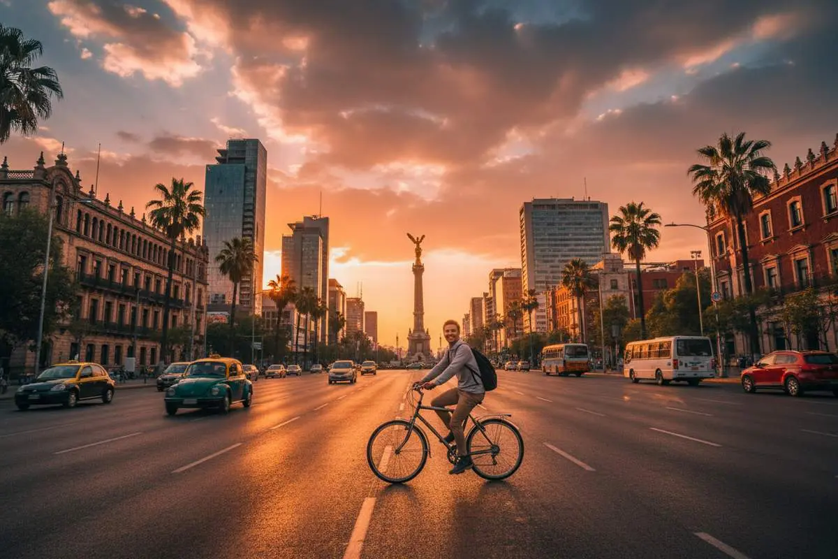
If you are wondering how to get around Mexico City as a tourist, the easiest answer is this: use Uber or DiDi for most trips, use the Metro when traffic is bad, and walk once you are inside neighborhoods like Roma, Condesa, Coyoacán, Polanco, and Centro Histórico.
That is the best Mexico City transportation plan for most first-time visitors. The Metro is cheap and fast, but it is not the best first move with luggage, late at night, or right after you land. Uber is easier for airport arrivals, evenings, and cross-neighborhood trips. Walking works once you are already in the area you want to explore.
Mexico City covers a huge area and can look chaotic on a map, but most tourists are only moving between a handful of districts. If you already know where to stay in Mexico City, which neighborhoods feel best for first-timers, whether Mexico City is safe, and how airport transportation works, getting around gets much simpler.
Best Way to Get Around Mexico City in 30 Seconds
- Best overall for tourists: Uber or DiDi
- Fastest in heavy traffic: Metro
- Best budget option: Metro or Metrobus at 6 MXN per ride
- Best for airport arrivals: Uber, DiDi, or an authorized airport taxi
- Best inside Roma, Condesa, Centro, Coyoacán, and Polanco: walk short distances, then use Uber or the Metro for longer hops
- What to avoid: unmarked taxis, random airport offers, and rush-hour Metro with large luggage

Quick-Reference: Which Mexico City Transport Option to Use When
| Situation | Best Option | Cost | Why it wins |
|---|---|---|---|
| Within Roma / Condesa | Walk | Free | Easiest for cafés, parks, and short daytime hops |
| Roma / Condesa → Centro Histórico | Metro or Uber | 6 MXN / 60-90 MXN | Metro is faster in traffic, Uber is easier door to door |
| Roma / Condesa → Coyoacán | Uber or Metro+walk | 80-130 MXN / 6 MXN | Uber is simplest, Metro saves money if you are traveling light |
| Roma / Condesa → Chapultepec | Walk or Metro | Free / 6 MXN | Short trip, easy either way |
| MEX airport → hotel | Uber, DiDi, or airport taxi | 180-300 MXN | Best mix of convenience and safety after a flight |
| Rush hour across town | Metro if near a line | 6 MXN | Usually beats road traffic by a lot |
| Anywhere after midnight | Uber only | 100-200 MXN | Safer and simpler than street taxis |
| Heading to a bus terminal for a day trip | Uber then bus | 50-80 MXN Uber | Best fit for Teotihuacán, Puebla, and other day trips |
| Felipe Ángeles airport (NLU) → city | ADO or Uber | 250-400 MXN | NLU needs different planning than MEX |
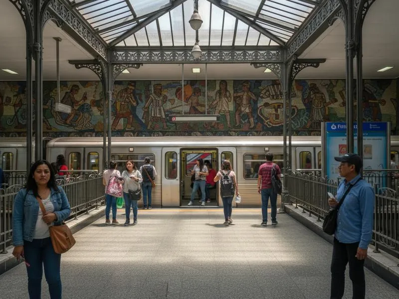
Metro: The Backbone of CDMX
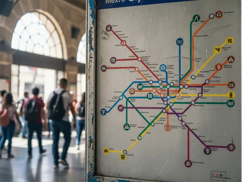
The Metro carries over 4 million passengers daily across 12 lines and 195 stations. For tourists, it’s the fastest way to cover long distances during daytime hours.
Why Use the Metro
- Price: 6 pesos (~$0.30 USD) per ride, any distance
- Speed: Faster than driving during peak traffic hours
- Coverage: Reaches Centro Histórico, Chapultepec, Coyoacán, airport (Terminal 1)
- Culture: Each station has a pictorial icon — designed so riders who couldn’t read could navigate. Worth noticing.
How to Use the Metro
Tickets:
- Buy at station booths (cash only, bring small bills)
- Ask for “un boleto” (one ticket) or load a rechargeable card
- Keep your ticket until exiting — occasional checks happen
- Price: 6 pesos regardless of how far you travel
Navigation:
- Follow signs showing the terminal station for your direction (e.g., “Dirección Observatorio” on Line 1 = heading west)
- Google Maps gives accurate metro directions — use it
- Each station has a unique pictorial icon displayed on all signs
- Download the CDMX Metro app for offline maps
Key Stations for Tourists
| Station | Line | What’s Nearby |
|---|---|---|
| Zócalo | 2 | Centro Histórico, main plaza, Templo Mayor |
| Bellas Artes | 2, 8 | Palacio de Bellas Artes, Alameda Central |
| Chapultepec | 1 | Park entrance, Anthropology Museum (10-min walk) |
| Insurgentes | 1 | Roma Norte, Condesa (10-min walk) |
| Polanco | 7 | Polanco neighborhood, Parque Lincoln |
| Viveros | 3 | Viveros de Coyoacán (jacarandas Feb-Mar) |
| Coyoacán | 3 | Coyoacán center (15-min walk or pesero) |
| Autobuses del Norte | 5 | TAPO bus terminal (buses to Teotihuacan from Gate 8) |
| San Lázaro | 1, B | TAPO bus terminal (Puebla, Oaxaca buses) |
| Terminal Aérea | 5 | Airport Terminal 1 |
Metro Tips
Rush Hours (7–9 AM, 6–8 PM):
- Cars become extremely crowded — physical contact is normal
- Avoid if you have luggage or claustrophobia
- If you must travel during rush, let several trains pass until you can board comfortably
Women and Children:
- First three cars reserved for women and children during peak hours
- Separate entrances marked on platforms
- Men will be directed out if they enter these cars at peak times
Safety:
- Keep valuables in front pockets, not back pockets or open bags
- Wear backpacks on your chest in crowded cars
- Be alert in stations, especially transferring between lines
- The metro itself is generally safe; common theft is opportunistic pickpocketing, not violent
Uber and Ride-Sharing: The Tourist Default
For most tourists, Uber is the primary mode. Safe, air-conditioned, no language barrier, no fare negotiation. CDMX has one of the highest Uber driver densities in the world — waits are usually 2-5 minutes.
Sample Uber Prices (approximate)
| Route | Fare (MXN) | Fare (USD) | Time |
|---|---|---|---|
| Roma → Centro Histórico | 60–90 | $3–5 | 15–25 min |
| Polanco → Coyoacán | 120–180 | $6–10 | 25–40 min |
| Airport → Roma/Condesa | 180–300 | $10–16 | 30–60 min |
| Roma → Chapultepec | 40–70 | $2–4 | 10–20 min |
| Centro → Xochimilco | 130–200 | $7–11 | 30–45 min |
Prices increase with traffic and surge pricing during rain or rush hour. Friday and Saturday nights run 30-50% higher.
Other Ride-Sharing Apps
DiDi: Often slightly cheaper than Uber. Works identically. Good alternative if Uber has surge pricing.
Cabify: Spanish competitor, similar to Uber. Less common but reliable.
InDriver: Allows fare negotiation — you propose a price, driver accepts or counters. More variable experience but can be cheaper for longer trips.
Ride-Sharing Safety
- Always verify car, plate, and driver photo match the app before getting in
- Share your trip location with someone when riding alone at night
- Have your destination address ready — showing your phone is fine
- If a driver asks you to cancel and pay cash, decline and report them
Taxis: Use When Uber Isn’t Available
Traditional taxis operate throughout the city. They’re generally safe but require more caution than app-based rides.
Types of Taxis
Sitio Taxis (Safest):
- Radio-dispatched from official stands
- Your hotel or restaurant can call one for you
- More expensive than street taxis but trackable
- Ask your hotel concierge for a trusted sitio number
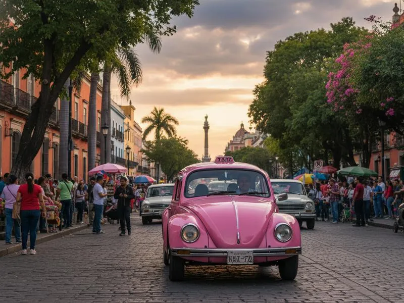
Street Taxis (Pink/White):
- Metered taxis you can hail on the street
- Look for official “A” or “B” license plates
- Make sure the meter starts when you get in
- Generally fine during daytime in tourist areas
Airport Taxis:
- Buy tickets at official booths inside terminals (before exiting)
- Fixed prices by zone — shown at the booth
- More expensive than Uber but convenient with luggage
- Safe and no negotiation needed
Taxi Safety Rules
- Never accept rides from people approaching you in arrivals halls or outside bars
- Never hail a taxi outside a nightclub or bar at night — use Uber
- Never get into an unlicensed or unmarked vehicle
- Always have small bills — drivers frequently “have no change”
- If anything feels wrong, don’t get in
Metrobus: Fast Surface Transit
The Metrobus runs articulated buses in dedicated lanes — faster than regular buses and useful for several tourist routes.
Useful Metrobus Lines for Tourists
| Line | Route | Tourist Use |
|---|---|---|
| Line 1 | Insurgentes from north to south | Roma → Condesa → Insurgentes Sur |
| Line 4 | Airport Terminal 1 → Centro Histórico | Airport access without Uber |
| Line 7 | Along Paseo de la Reforma | Chapultepec → Angel de la Independencia |
How to use:
- Requires a rechargeable card (sold at stations for 10 MXN deposit + load amount)
- Cost: 6 pesos per ride
- Not recommended with large luggage during rush hour
- Faster than driving on Insurgentes during traffic
Ecobici and Bikes: Best for Short Daytime Hops
Mexico City’s bike-share system, Ecobici, works well in the central core, especially around Roma, Condesa, Juárez, Reforma, Polanco, and parts of Centro. If you are staying in these neighborhoods and want a fast way to cover short distances without sitting in traffic, it can be a smart option.
When Bikes Make Sense
- Short daytime trips on Reforma or between Roma and Condesa
- Sundays, when parts of Reforma often feel calmer and more bike-friendly
- Travelers already comfortable cycling in big cities
When Bikes Do Not Make Sense
- Your first day in the city, when altitude and traffic feel unfamiliar
- Rainy afternoons, which are common in season
- Late-night trips or routes with heavy traffic and unclear bike-lane coverage
For most visitors, bikes are a nice extra, not the main transport strategy. If you only want the simplest plan, stick with Metro + Uber + walking.
Walking: Best for Neighborhoods
Several of CDMX’s best areas reward walking — Roma, Condesa, Centro Histórico, Coyoacán, Polanco, and San Ángel.
Walkable Distances
| Route | Walking Time | Notes |
|---|---|---|
| Roma Norte → Condesa | 10–15 min | Flat, safe, pleasant |
| Zócalo → Bellas Artes | 15 min | Through pedestrian Madero street |
| Coyoacán plaza → Casa Azul | 10 min | Core Coyoacán circuit |
| Roma → Centro Histórico | 45+ min | Better by metro |
| Polanco → Chapultepec Park | 10 min | Easy walk |
Walking tips:
- Sidewalks can be uneven — watch your step, especially in Centro
- Traffic doesn’t always yield at crossings — wait for clear gaps
- Altitude (2,240m): walking feels more tiring your first 1-2 days; drink extra water
- Distances on maps look shorter than they are — CDMX blocks are long
Airport Transportation (MEX — Benito Juárez)
Mexico City’s main airport has two terminals connected by a monorail. Most international flights use Terminal 1.
Options from MEX to Your Hotel
| Option | Cost | Time | Best For |
|---|---|---|---|
| Uber / DiDi | 180–300 MXN | 30–60 min | Most travelers |
| Authorized airport taxi | 250–400 MXN | 30–60 min | No smartphone, large luggage |
| Metrobus Line 4 (T1 only) | 6 MXN | 45–70 min | Traveling light to Centro area |
| Metro Line 5 (T1 only) | 6 MXN | 45–70 min | Experienced travelers, no luggage |
Uber pickup: Follow signs to “Aplicaciones de movilidad” or authorized app pickup zones outside arrivals. Don’t accept rides from people inside the terminal.
NAICM / Felipe Ángeles (NLU): The second airport north of the city. Served by ADO bus (around 250 MXN, 60–90 min to central bus terminals) or Uber. If you’re flying into NLU, plan accordingly.
Getting to Bus Terminals (Day Trips)
For day trips and intercity travel, you’ll use one of four main terminals:
| Terminal | Metro | Destinations |
|---|---|---|
| Terminal del Norte | Autobuses del Norte (L5) | Teotihuacan, Querétaro, Monterrey, Guadalajara |
| TAPO (Oriente) | San Lázaro (L1/B) | Puebla, Oaxaca, Veracruz, Chiapas |
| Terminal del Sur | Taxqueña (L2) | Cuernavaca, Taxco, Tepoztlán, Acapulco |
| Terminal Poniente | Observatorio (L1) | Toluca, Valle de Bravo |
Teotihuacan buses depart from Terminal del Norte, Gate 8. Buses leave every 30 minutes starting at 7 AM. Cost: ~92 MXN round-trip. See the full day trips from Mexico City guide for details.
What NOT to Do in Mexico City Transportation
- Don’t rent a car for city exploration — traffic, parking, and stress aren’t worth it
- Don’t hail unmarked taxis, especially at night
- Don’t take the metro with large luggage during 7–9 AM or 6–8 PM rush hours
- Don’t walk between distant neighborhoods after dark — use Uber
- Don’t accept rides from people approaching you at airports or bus stations
- Don’t assume Uber is always fastest — during rush hour, metro beats it
Mexico City Transportation: Bottom Line
The easiest way to get around Mexico City is to combine Metro for speed, Uber or DiDi for comfort, and walking for neighborhood exploration. That mix covers almost every tourist itinerary without the cost and stress of renting a car.
Use the Metro when traffic is bad and you are traveling light. Use Uber at night, from the airport, or when you want a direct ride. Walk when you are exploring compact areas like Roma, Condesa, Centro Histórico, Coyoacán, and Polanco.
For the rest of your trip planning, pair this guide with our Mexico City travel guide, things to do in Mexico City, Mexico City food guide, Mexico City neighborhoods guide, where to stay in Mexico City, is Mexico City safe?, day trips from Mexico City, and Mexico City airport transportation guide.