Is Chiapas Safe to Travel to in 2026? Safe Areas, Border Zones, and Tourist Advice
Yes, Chiapas is safe to travel to in 2026 for most tourists if you stay on the standard traveler route, especially San Cristóbal de las Casas, Tuxtla Gutiérrez, Chiapa de Corzo, Cañón del Sumidero, Agua Azul, Misol-Há, and Palenque. The state is still under a Level 2 advisory overall, which means increased caution, not “do not travel.”
If what you really want to know is whether Chiapas is safe for tourists right now, the short answer is also yes, with one big condition: keep your trip on the main corridor and do not freelance into unstable border areas just because a map makes them look nearby. San Cristóbal is still the safest first-timer base, Palenque is still the easiest ruins-and-waterfalls hub, and the safest first trip is usually Tuxtla → San Cristóbal → Sumidero → Palenque.
The parts that deserve extra caution are the Guatemala border zone, remote jungle routes, and any road where protests or criminal groups are causing sudden blockades. For most visitors, the real disruptions are practical, not dramatic: long road delays, night driving in the mountains, altitude in San Cristóbal, and not understanding local rules in indigenous communities.
This guide breaks down what is actually safe, what has changed recently, and how to plan Chiapas with the right amount of caution instead of generic fear.
Chiapas Safety in 30 Seconds
| Question | Short answer |
|---|---|
| Is Chiapas safe for tourists? | Yes, on the main tourist corridor. |
| Safest base for first-timers | San Cristóbal de las Casas |
| Safest ruins stop | Palenque |
| Biggest real risk | Road blockades and long transport delays |
| Most overblown fear | Tourists being targeted in the main corridor |
| Main areas to avoid | Guatemala border zone and unstable remote jungle routes |
| Should you rent a car? | Yes by day, but avoid night driving and check route conditions first |
What Matters Most Right Now
| If you are worried about… | What matters most |
|---|---|
| Cartel headlines | They matter far more near the Guatemala border than on the normal San Cristóbal to Palenque tourist route |
| Choosing a base | San Cristóbal is still the safest and easiest first base for most travelers |
| Border-zone confusion | Do not add Frontera Comalapa or remote border detours to a normal first trip |
| Getting stranded | Check for bloqueos before any long road day, especially San Cristóbal to Palenque |
| Whether Palenque is still worth it | Yes, Palenque town and the ruins remain workable for tourists |
| Whether Tuxtla is safe | Yes, as a gateway city with normal urban precautions |
Safest Chiapas Route for a First Trip
| If this is your trip… | Best route |
|---|---|
| First Chiapas trip | Tuxtla → San Cristóbal → Sumidero → Palenque |
| You only have 2 to 3 days | Tuxtla + San Cristóbal |
| You care most about ruins and waterfalls | Palenque + Agua Azul + Misol-Há |
| You want the lowest-stress plan | Base in San Cristóbal and use organized day trips |
| You want to avoid unstable zones entirely | Stay on the Tuxtla / San Cristóbal / Palenque corridor |
Best Chiapas Base by Trip Style
| Trip style | Best base | Why |
|---|---|---|
| First-time visitor | San Cristóbal | Best traveler infrastructure, easiest day trips, strongest tourist presence |
| Ruins and waterfalls | Palenque | Best base for ruins, Misol-Há, and Agua Azul |
| Short 2 to 3 day trip | Tuxtla + San Cristóbal | Easiest airport access and quick canyon/highlands mix |
| Family trip | San Cristóbal | Walkable center, organized tours, easier logistics than remote routes |
| Independent road trip | San Cristóbal + Palenque | Best combo if you want the classic corridor without border-zone risk |
Is San Cristóbal, Palenque, or Tuxtla Safer Right Now?
| Place | Verdict | What to know before you book |
|---|---|---|
| San Cristóbal de las Casas | ✅ Best first-timer base | Strongest tourist presence, easiest walking core, and the clearest fit if you want cafés, markets, and organized day trips |
| Palenque | ✅ Safe for ruins trips | The main risks are transport timing, taxi pricing, and waterfall logistics, not tourists being targeted |
| Tuxtla Gutiérrez | ✅ Fine as a gateway city | Best for airport access and Sumidero logistics, but less pleasant than San Cristóbal for late-night walking or a long stay |
| Guatemala border zone | ❌ Avoid independently | Security picture is more volatile and not worth folding into a normal first Chiapas trip |
The Advisory: What Level 2 Actually Means
The US State Department issues travel advisories on a 1-4 scale:
| Level | Meaning | Examples |
|---|---|---|
| 1 — Exercise Normal Precautions | Routine awareness | Most of Europe |
| 2 — Exercise Increased Caution | Real risks, manageable | Chiapas (and France, Germany, UK) |
| 3 — Reconsider Travel | Elevated risk | Parts of Baja California Sur near cartel territory |
| 4 — Do Not Travel | Extreme danger | Active conflict zones |
Chiapas sits at Level 2 overall, with some border areas elevated to Level 3.
Level 2 does not mean “dangerous.” It means “be aware, take standard precautions, pay attention.” Every experienced traveler going to Chiapas should do exactly that — not because Chiapas is unusually risky, but because any trip to a new place requires awareness.
The Dangerous Zones vs. the Tourist Corridor
This is the main distinction that matters, and it is where most weak safety guides blur the picture.
If you only remember one thing from this page, make it this: the Chiapas trip most travelers actually take is not the same as the Chiapas routes creating the worst headlines. The normal tourist circuit is still centered on San Cristóbal, Sumidero, waterfalls, and Palenque. The higher-risk picture shows up when people push closer to the Guatemala border or remote eastern routes without checking current local conditions.
Higher-risk areas to avoid or treat carefully:
- Border region with Guatemala, especially around Frontera Comalapa and remote crossings
- Isolated jungle zones in eastern Chiapas away from mainstream tourism logistics
- Roads with active protest blockades or sudden security incidents
- Remote archaeological routes that have faced closures, access disputes, or unstable conditions
Main tourist corridor that remains viable for visitors:
- San Cristóbal de las Casas
- Chiapa de Corzo and Cañón del Sumidero
- Agua Azul and Misol-Há waterfalls
- Palenque, including the town and main ruins site
- Comitán and the Montebello Lakes with current local route checks
The route most visitors actually use runs from Tuxtla Gutiérrez to San Cristóbal, then onward to the canyon, waterfalls, and Palenque. That core circuit still receives steady tourism.
What has changed is that some farther-flung Chiapas routes need more caution than older blog posts suggest. If a site or road in the eastern jungle is dealing with closures, land disputes, or organized crime pressure, do not assume yesterday’s itinerary is still fine. Ask your hotel or operator what is working this week.
Which Chiapas Routes Are Usually Fine, and Which Need More Caution?
| Route or area | Verdict | Why |
|---|---|---|
| Tuxtla Gutiérrez to San Cristóbal | ✅ Usually fine | High tourist use, frequent transport, easy to check live conditions |
| San Cristóbal to Chiapa de Corzo / Sumidero | ✅ Usually fine | Standard day-trip corridor with constant visitor traffic |
| San Cristóbal to Palenque | ⚠️ Fine with checks | Classic route, but delays and blockades can disrupt the day |
| Palenque town to ruins | ✅ Usually fine | Short, heavily traveled tourist route |
| Palenque to Agua Azul / Misol-Há | ✅ Usually fine in daylight | Tourist traffic is normal, but road timing still matters |
| Remote eastern jungle detours | ⚠️ Situation-dependent | Closures and local instability can change quickly |
| Guatemala border region | ❌ Avoid independently | Smuggling routes and more unstable security picture |
Real Risks in Chiapas for Tourists
Ranked by how likely you are to actually encounter them:
1. Bloqueos (Road Blockades) — Most Common Disruption
This is the #1 practical risk in Chiapas that most travel guides ignore entirely.
The CNTE (Coordinadora Nacional de Trabajadores de la Educación — Mexico’s dissident teachers’ union) regularly blockades highways in Chiapas and neighboring Oaxaca. When negotiations with the federal government break down, they set up human blockades on major routes, sometimes for hours, sometimes for days.
Most affected routes:
- Highway 190 near Juchitán/Tehuantepec (between Oaxaca and Chiapas)
- Highway 199 between San Cristóbal and Palenque
- Approach roads to Tuxtla Gutiérrez
What to do: Check with your hotel before any long road trip. Follow local Facebook groups where travelers report current conditions. Build buffer time into travel days. If a bloqueo is active on your planned route, wait it out or explore alternative routing via Villahermosa instead.
The bloqueo risk doesn’t mean you’ll definitely encounter one. Many travelers go through Chiapas without any issues. But it’s the risk that most surprises unprepared tourists — not violent crime.
2. Altitude Sickness — Often Underestimated
San Cristóbal de las Casas sits at 2,200 meters (7,200 feet) above sea level — significantly higher than Denver, Colorado (1,609m).
If you’re arriving from the coast (Cancún, Playa del Carmen, Puerto Escondido), the change is extreme. Common symptoms: headaches, fatigue, shortness of breath, nausea, disturbed sleep.
How to handle it:
- Drink plenty of water (aim for 3+ liters/day your first two days)
- Avoid heavy alcohol your first night
- Eat light meals — avoid heavy, rich food for the first 24 hours
- Sleep is often the most affected — take naps, rest more than usual
- Altitude medication (acetazolamide/Diamox) is available at Mexican pharmacies; consult a doctor before use
Most people feel better after 24-48 hours. If symptoms are severe or worsening after 48 hours, descend to lower altitude.
3. Photography Violations in Indigenous Communities
San Juan Chamula: Photography is strictly prohibited inside the Chamula church. This is not a tourist guideline — it’s enforced by community authorities who have the legal right to detain visitors and confiscate equipment. Every year, tourists who ignore this rule get their cameras taken or are escorted out by community police. Outside the church, street photography is generally accepted but always ask first.
Zinacantán: Photography rules are less strict but ask permission before photographing people, especially during ceremonies.
Yaxchilán and remote Lacandón communities: Treat photography as a privilege, not a right. Ask before shooting.
Respecting these rules isn’t just legal protection — it’s the right thing to do when visiting communities that have maintained their traditions against enormous external pressure.
4. Petty Theft in Crowded Markets
The Mercado Municipal and Mercado del Carmen in San Cristóbal are lively and generally safe but attract professional pickpockets during peak hours (10 AM–2 PM). Keep valuables secured and be aware in tight spaces. Don’t leave camera bags hanging off chairs in restaurants near market areas.
5. Night Driving on Mountain Roads
Highway 199 between San Cristóbal and Palenque is a mountain road with significant elevation changes, tight curves, fog, and minimal guardrails in sections. Night driving is not recommended. Depart for Palenque no later than noon to arrive before dark.
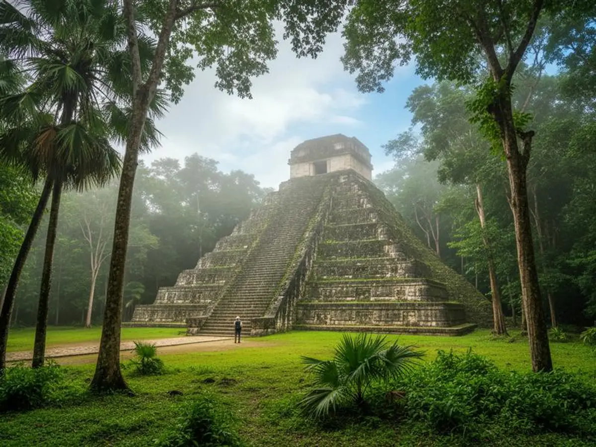
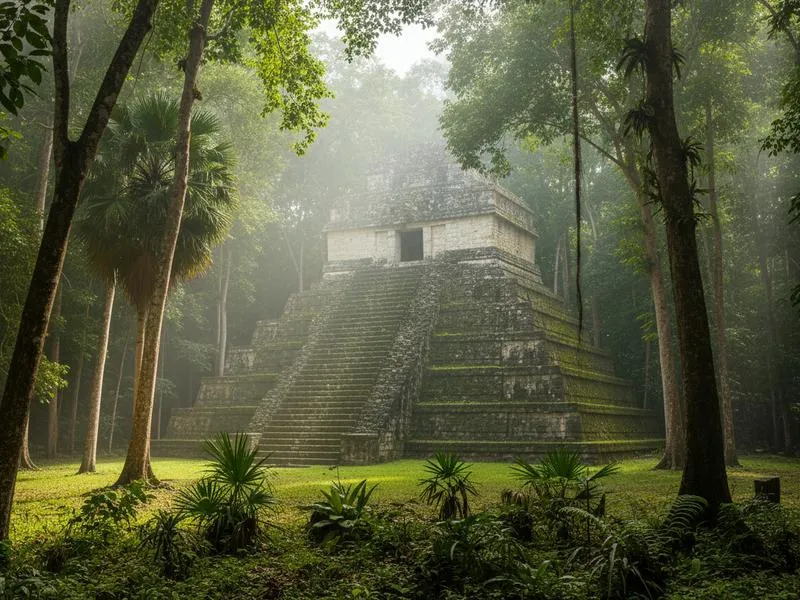
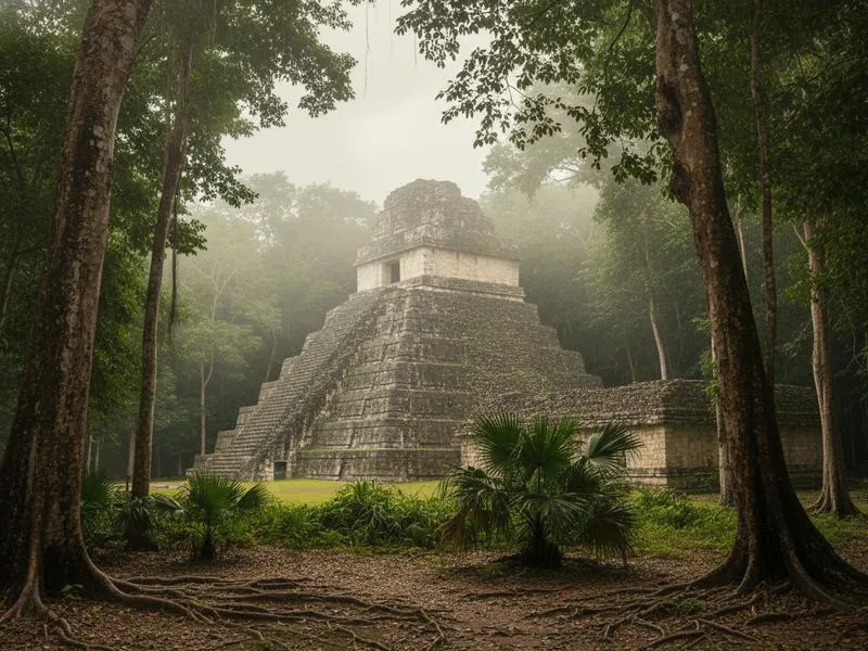
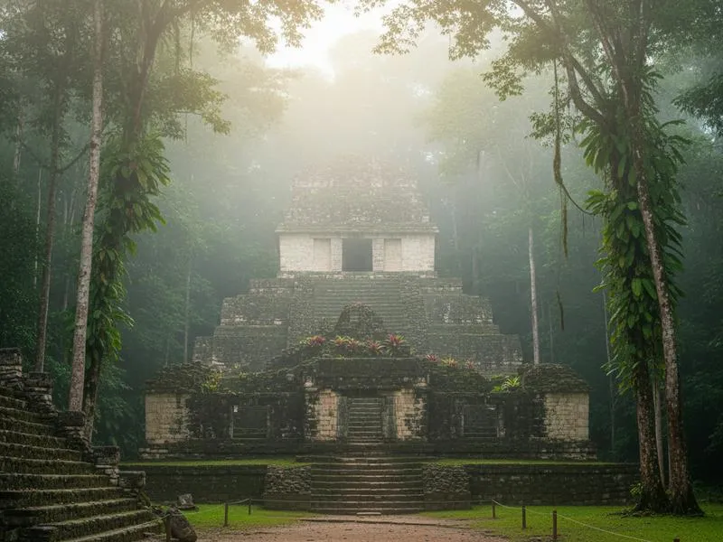
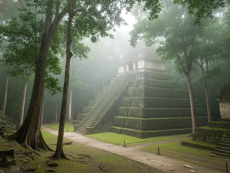
Is Palenque Safe?
Yes. Palenque town (population ~50,000) and the archaeological site are safe for tourists.
The ruins themselves have professional security guards, a well-developed entrance system, and receive tourists continuously. The site is run by INAH (Instituto Nacional de Antropología e Historia) with a safety-conscious management structure.
Practical tips for Palenque:
- Agree on taxi fares before getting in — from the ruins to town is a negotiation, not a meter
- The walk from the ruins to El Panchan (tourist zone) is manageable in daylight; use taxis at night
- Don’t visit Agua Azul waterfalls between May-October — the water turns brown/murky from rain runoff. The turquoise color that fills every photo? Only November-April.
- Misol-Há waterfall is beautiful year-round and less dependent on seasonal conditions
Is Tuxtla Gutiérrez Safe?
Yes, Tuxtla Gutiérrez is generally safe for travelers using it as an airport and transport hub, especially if your plan is a night near TGZ, a Cañón del Sumidero boat trip, or an onward transfer to San Cristóbal.
The reason Tuxtla worries some travelers is not that it is one of Mexico’s more dangerous tourist cities. It is that it feels more like a working inland city than a charming traveler base, so people compare it to San Cristóbal and assume that difference means it is unsafe. In practice, the right comparison is not “Can I wander for hours like in a colonial center?” but “Can I land, sleep, get dinner, and move on safely?” For most tourists, yes.
Use Tuxtla this way:
- Stay near a known hotel zone, Plaza Cristal, or the routes travelers use for TGZ airport transfers
- Use Uber or a registered taxi after dark instead of long walks through unfamiliar areas
- Treat it as the most efficient base for TGZ + Chiapa de Corzo + Sumidero, not as Chiapas’s best nightlife or café city
- If you want a more enjoyable long stay, move on quickly to San Cristóbal once you land
Safety by Location: Quick Reference
| Location | Safety Level | Main Risk | Tourist Volume |
|---|---|---|---|
| San Cristóbal de las Casas | ✅ Generally safe | Altitude, petty theft in markets | High, year-round |
| Palenque town + ruins | ✅ Generally safe | Taxi pricing, long transfers, night driving | High, year-round |
| Cañón del Sumidero | ✅ Generally safe | Standard tour logistics | High |
| Agua Azul / Misol-Há | ✅ Generally safe | Highway delays, seasonal conditions | Medium |
| Comitán + Montebello area | ✅ Usually safe | Check route conditions before driving | Medium |
| Tuxtla Gutiérrez | ✅ Generally safe | Standard urban precautions | Medium |
| Remote eastern jungle routes | ⚠️ Situation-dependent | Closures, access issues, local instability | Low |
| Border with Guatemala | ❌ Avoid independently | Criminal activity, smuggling routes | Very low |
Getting Around Chiapas Safely
No Uber in San Cristóbal. Uber doesn’t operate in San Cristóbal. Taxis are the standard option — agree on price before getting in. Most rides within the centro cost 30-60 MXN. At night, use taxis from taxi stands rather than flagging one on the street.
Organized tours for remote sites. Yaxchilán and Bonampak require organized transportation from Palenque or San Cristóbal. Don’t attempt these independently unless you have extensive Mexico off-road experience and local contacts. The logistics (boat on the Usumacinta River for Yaxchilán, jungle roads for Bonampak) require guides who know the current conditions.
Highway 199 timing. If driving San Cristóbal to Palenque (or vice versa), leave early. The 4-5 hour drive involves mountain switchbacks, potential bloqueos, and dramatically different weather between the two endpoints. Don’t start after noon.
Fly into Tuxtla Gutiérrez (TGZ) instead of driving from Oaxaca. If you’re coming from Cancún or another major hub, flying to TGZ and taking Uber/taxi to San Cristóbal (80 km, 90-120 minutes) is far easier than the overland route and avoids any bloqueo risk from the Oaxaca direction.
Is Chiapas Safe: Traveler Profile Table
| Traveler Type | Verdict | Key Advice |
|---|---|---|
| Solo female traveler | ✅ Generally safe | San Cristóbal has a strong expat/traveler scene; stick to tourist zones at night; take taxis after dark |
| First-time Mexico visitor | ✅ Good choice with preparation | Read up on bloqueos and altitude before you arrive; don’t skip this page |
| Couple/group | ✅ Great destination | Book organized transport for Yaxchilán/Bonampak |
| Family with kids | ✅ With planning | Altitude can hit kids harder — plan rest days; San Cristóbal and Palenque are suitable |
| Budget backpacker | ✅ Excellent value | San Cristóbal has some of Mexico’s best budget hostels; street food and markets are cheap |
| Digital nomad / long-stay | ✅ Strong choice | SCP has cafes, coworking spaces, expat community, and Mexico’s most unique cultural scene |
| Adventure traveler | ✅ With guides | Cañón del Sumidero, caving near San Cristóbal, Lacandón routes — use local guides |
| Elderly / mobility limited | ⚠️ Plan carefully | Altitude is real; San Cristóbal’s cobblestone streets are challenging; Palenque ruins are steep |
Chiapas vs. Other Mexican States: Safety Context
| Destination | Advisory Level | Tourist Corridor Safety | Similar To |
|---|---|---|---|
| Chiapas | Level 2 | ✅ Tourist corridor safe | Oaxaca, Guerrero (same reasoning) |
| Oaxaca | Level 2 | ✅ City and valley safe | Chiapas |
| Guerrero (Taxco) | Level 3 | ✅ Taxco tourist zone safe | — |
| Baja California | Level 3 | ✅ Tourist corridor safe | — |
| Yucatán | Level 1 | ✅ Entire state | Northern Europe |
| Quintana Roo | Level 2 | ✅ Tourist zones safe | Chiapas |
| CDMX | Level 2 | ✅ Tourist neighborhoods safe | Rome, Paris |
The pattern is consistent across Mexico: advisory level reflects entire states, not tourist corridors. Chiapas is not safer than Yucatán — but it’s not nearly as dangerous as a superficial reading of “Level 2 with parts at Level 3” implies for tourists who stick to established routes.
Before You Go: Practical Safety Tips
-
Download offline maps. In the highlands and jungle, cell signal is unreliable. Google Maps offline or Maps.me works without data.
-
Carry cash. ATMs exist in San Cristóbal and Palenque but are unreliable in smaller towns. Withdraw before leaving the city.
-
Check bloqueo conditions with your hotel or hostel before any road day trip. This takes 2 minutes and can save you hours.
-
Respect photography rules in every indigenous community. When in doubt, don’t shoot.
-
Hydrate aggressively in San Cristóbal. The altitude dehydrates you faster than you’d expect.
-
Use Tuxtla as a logistics city, not your romanticized Chiapas base. It is useful because of TGZ airport access and canyon connections, not because it is the most atmospheric place to linger.
-
Do the Cañón del Sumidero by boat. Don’t try the road to the mirador without a rental car and good navigation. The boat tour from Chiapa de Corzo is safer, cheaper, and more straightforward for most visitors.
-
Treat remote jungle sites as current-conditions trips, not fixed itinerary items. If a route or ruin has recent closures, access disputes, or security issues, skip it and keep your trip focused on the main corridor.
-
Use this page with the broader safety cluster before you book. Read Mexico Travel Advisory 2026, Is Mexico Safe?, Is San Cristóbal Safe?, and Is Palenque Safe? so you understand the bigger context.

The Bottom Line
Chiapas is generally safe for tourists who stick to the established route and travel with current information. The safety picture is not “all clear,” but it is also nowhere near as alarming as generic Mexico headlines make it sound.
The risks you should actually plan for are:
- Bloqueos: Check road conditions, leave early, and keep your schedule flexible
- Altitude: Hydrate, rest, and take San Cristóbal slowly on day one
- Photography rules: Learn them before visiting indigenous communities
- Remote routes: Skip anything dealing with closures, access disputes, or unstable border-area conditions
If your plan is San Cristóbal, Chiapa de Corzo, the canyon, the waterfalls, and Palenque, Chiapas remains one of Mexico’s most rewarding states to visit. Just plan it like an informed traveler, not like every route in the state carries the same level of risk.
Related Safety Guides
- Is Mexico Safe? Honest Guide by a Mexican
- Mexico Travel Advisory 2026: All 32 States Explained
- Is San Cristóbal de las Casas Safe?
- Is Oaxaca Safe?
- Safest Cities in Mexico
- Getting Around Mexico Safely